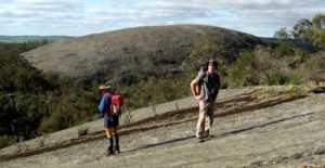
A late spring in the step
Someone asked recently: If you had to choose 10 easier walks for this time of year (late Spring) what would they be?
It’s always difficult to select preferred walks, especially for others. All the walks on WalkGPS should be enjoyable in the right weather, but by late spring many days will already be too warm for comfort and enjoyment for the longer walks. – Long, challenging bushwalks on days when a daily max of 26 deg C or greater (in the shade) is forecast are only for the masochists among us! – But you can still achieve a lot of good walking by getting an early morning start, by keeping the distance short, preferably say 10km, and by finishing early (before noon).
Most of the walks on WalkGPS are longer than 10km and without adjustment will not be comfortably enjoyable on the hotter days, especially the walks that are largely cross-country (‘off-track’). Happily though, it’s easy to make some simple variations to several of the walk routes to shorten them. Most of the shortened walks can also be achieved without GPS.
The following then is a shortlist of 10 or so walk ideas for this time of year. (These are in no particular order.) Check through the maps and descriptions on WalkGPS for much more information on each walk area (the links are included below) and/or to work out other possible walk options for yourself:
Bold Park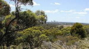 (link) – No GPS required, just an easy ‘introductory’ stroll on well formed tracks around a hilly bushland park close to the city and near the coastal beaches. The bushland here is quite different to the jarrah forest and wandoo woodlands of the Darling Range.
South Ledge area-Mundaring Weir – Rather than doing the full 13.5 km circuit of the North Ledge-South Ledge WalkGPS walk route, I recommend that at this time of year you bypass the northern portion of the walk (North Ledge) and try the following variation for a total walk distance of just over 10km:
 Park in the parking area at the historic No. 1 Pump Station (C.Y. O’Connor Museum) off Mundaring Weir Rd below the Mundaring Weir dam wall. Then follow the path up to the northern end of the dam wall and cross the wall to the southern end to Mundaring Weir Rd; then head uphill along the Road for about 150m to follow the Bibbulmun Track around to South Ledge (Golden View lookout) and on to Hewett’s Hill Campsite (hut). Then return on Bibb. Track as far as the Kattamorda Track crossing, then follow the Kattamorda Track (in orange on my map on WalkGPS) down the hill to meet Mundaring Weir Rd and follow it northward for about 150-200m to locate the side road back to start point. The No 1. Pump station museum is worth visiting if it is open (see notes on WalkGPS).
Victoria Reservoir – Bickley Brook – This is a pleasant, almost all on track 10.5 km walk with some nicely varied forest. Despite a couple of hill climbs, with an early start, this is a good one for this time of year.
Piesse Brook (Kalamunda) – This is all on track, GPS not essential, though it’s useful for finding the correct turns and a couple of fairly subtle side-tracks. If you leave out the northern loop and turn around at ‘Rocky Pool’ you will reduce the distance to around 7-8 km which will make some of the steepish hills easier to manage on a warm day.
Eagle’s View Walk (John Forrest National Park)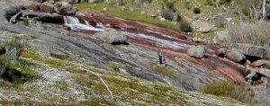 – This is a 15km circuit and therefore a bit too long on a really warm day, but nevertheless it is on a well formed and marked trail all the way. It’s a pleasant walk through a mixture of heathlands and jarrah forest and some wandoo woodland. Make sure you drink plenty of water along the way, and wear a good hat.
Kattamordo Variation (Pickering Brook) – This on-track walk can be done fairly easily without GPS though a few of the track junctions/turning points can be a bit confusing and easily missed. It’s a nicely varied walk – the forest sections are broken up with patches of farmland/orchards. To shorten the walk for this time of year, the simplest option is to cut out the northern ‘half’ of the figure-of-8 route by taking the ‘JCN-X’ option to reduce the walk to 9 kms.
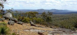
Three Mountains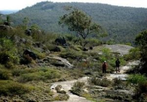 – This is a really nice walk area, but two ‘mountains’ is probably enough for most walkers at this time of the year as the hill climbs can become fairly tiring in warm weather! A better option at this time of year would be to skip the Mt Randall section (in the WalkGPS Three Mountains route description) and instead park at the Sullivan Rock Picnic area (at ‘End’ point of walk) then follow the well-marked Bibbulmun Track northward across Mt Vincent to the large granite outcrop on the northern flank of Mt Cuthbert, then for a 9-9.5km total walk either
i) turn around and return the same way; or
ii) locate and descend (steeply) the old ‘climbers track’ down the west side of Mt Cuthbert from near the SW edge of the large granite outcrop (see map on WalkGPS), to meet the ‘Old Bibbulmun Track’ (an old vehicle track) and follow it back to rejoin the Bibbulmun Track near Sullivan Rock to return to the start.
A third option is to continue on the Bibb. Track north from Mt Cuthbert to Monadnocks Campsite (hut) on Bibb. Track, and then return via the ‘Old Bibbulmun Track’. That option gives a longer (14.5km) total walk, but the return along the ‘Old Bibb. Track’ is easy walking (again see map on WalkGPS).
Note: DEC did some controlled, fuel-reduction burning this year (2010) in the forest along the east flank of Mt Cuthbert which will have left parts of the forest near the track looking a bit bleak and blackened at present.
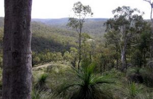
Mount Cooke – The forest here is still recovering from a major bushfire in early 2003 but after the initial climb up the southern exposed granite slope, the walking is pleasant and the views are excellent.
 The 10km “easy version” is the best choice at this time of year and is mostly on-track and follows the well-marked Bibbulmun Track across the top of Mt Cooke. After a rest stop at Mt Cooke Campsite, the return section along the SW footslope of Mt Cooke is easy walking.
The only ‘tricky’ bit about this walk is locating the start point which is at the end of a narrow dirt vehicle track through a young pine plantation. (The vehicle track is a little rutted in places but I’ve driven it easily enough earlier this year in a large Ford sedan, so you shouldn’t need 4WD provided you drive slowly and carefully. Preferably you need GPS to locate the correct dirt road off the Albany Highway (it’s not an obvious turn) and to follow the initial 600m off-track walk section to meet the Bibbulmun Track.
Christmas Tree Well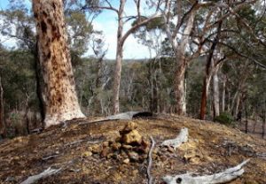 – or shortened versions of other walks in the wandoo woodlands off Yarra Road. – GPS navigation is advisable for the wandoo walks. The Christmas Tree Well circuit, at 12.5km, is the shortest of these cross-country walks, but can easily be shortened to around 10km: After reaching the approx. halfway point on the route described on WalkGPS simply head more-or-less directly in a WSW direction back to the Christmas Tree Well picnic area (the start point) by approximately following the floor of the side valley that drains the Christmas Tree Well area (see WalkGPS map).
The wandoo woodlands are more picturesque and offer some delightful variety after the often fire-blackened jarrah forest further west. If you only do a short walk, you can then drive the full 46 km length of Yarra Road (i.e. from Brookton Highway in the south to Great Southern Highway in the north which makes an interesting circuit for the drive to and from Perth. The lengthy drive along the dirt road is a bit of an experience in itself (be careful of kangaroos crossing the road if driving early morning!
Kittys Gorge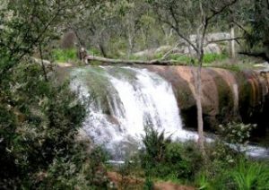 – Kittys Gorge Trail seems to be one of the most popular walks with the general public (perhaps because it has been listed on “Top TrailsWA” website), but is best after rain when the falls and cascades are flowing well. The Gooralong Brook down the little gorge is unfortunately much-infested with weeds which can be a disappointment for those expecting to see ‘pristine’ bushland! If you do want to visit the area, don’t try my full WalkGPS walk route (Serpentine Falls – Kittys Gorge) at this time of year; Instead of parking at Serpentine Falls, park at the Jarrahdale township opposite the cemetery in Atkins Street, then follow the marked Stacey’s Trail to connect on to Kittys Gorge Trail. Then follow Kittys Gorge Trail as far as the Serpentine River crossing near Spencers old mud cottage. Then return along Kittys Gorge back to the old Gooralong Picnic area to again link up with the Stacey’s Trail circuit and return to the start point. The total walk is then 10km.
Note: On a cooler day, instead of returning directly back to the picnic area along Gooralong Brook you can opt to cross Gooralong Brook at the footbridge (near a flow-gauge station) about 2km along the track northward from Serpentine River. Then follow an old vehicle track southward up the hillside, and then the trail markers N-NE-ward along a foot-track to again get back to the old Gooralong Picnic area and link up with Stacey’s Trail to return to the start point (see map on WalkGPS). The option increases the total walk to 12km.
Further away:
Dryandra – For lots of beautiful wandoo woodlands. It’s a longer drive from Perth, but you can either camp at Congelin Campsite overnight or try to book one of the old foresters’ cottages at the Lions Village at Dryandra itself. There are a couple of shorter walks there (Lol Gray and Woylie walk etc) that are more suitable at this time of year.
 Boyagin Rock – Also some lovely woodlands and a big granite dome. You can include a visit to Boyagin Rock on a drive back from Dryandra. The walk to the top of the rock is short but very worthwhile. Don’t try the full WalkGPS walk route at this time of year.
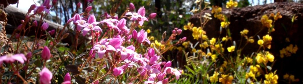
Finally, when walking at this time of year be realistic in your expectations. Your earlier morning starts will be rewarded with the sounds of stirring bird-life, but don’t expect to see bountiful wildflowers in late spring/early summer, though there are still lots to be spotted for the keen observer. And, after a dry winter and spring (in 2010), don’t expect to-see flowing water and moss-covered outcrops. And, be mindful that with the warmer weather, snakes are becoming active but may still be slow to move out of your way in the cooler, early morning, -so take care where you tread!
Enjoy!
DISCLAIMER: Please read the WalkGPS disclaimer before considering any of the above walks. You must exercise your own independent judgment as to whether the walk routes suggested on this site are safe for you taking account of your fitness, training, skills and experience.
Comments