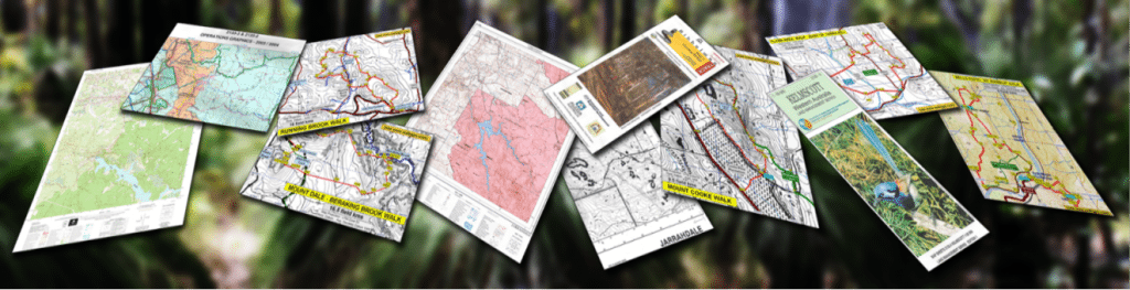
Maps & GPS
Avenza Maps – 100 custom WalkGPS walk area maps for smartphone app users.
DBCA Conservation Operations Graphic (COG) maps (1:50,000 scale) – These ‘interim’ maps display the best topographic and cadastral information available to DBCA each year, but they are not intended to be of typical published map quality. The block colouring for DBCA land tenure and management purposes conceals much of the contour detail of interest to bushwalkers. The map sheets are printed on demand and can be ordered online.
Google Earth satellite imagery.
Landgate ‘Locate’ service – Locate is an interactive mapping tool that gives you the flexibility to overlay Landgate’s aerial photography and a whole suite of other property related information such as roads, historical maps and facilities. ‘Locate’ also allows you to quickly and easily view SLIP public services (see below) in a map. Topographic maps (as print-enabled PDF files) at 1:25k, 1:50k and 1:100k scales can be ordered online.
Landgate ‘Map Viewer Plus’ – An interactive online mapping application for the discovery of land and property information and related purchasable products.
Landgate Shared Location Information Platform (‘SLIP’) – Offers a wide range of maps, web services (APIs) and data downloads.
Maps relating to the “Forest Management Plan 2024-2033” (1:500,000 scale; Conservation & Parks Commission) – See FMP Map 2 (Existing Land Categories) and Map 12 (Proposed Land Categories), downloadable as pdf files, showing the gross boundaries of parks, reserves and State forests across the whole southwest region of the State.
Memory-Map’s Topo WA Seamless topo maps covering WA at scales of 100k, 50k and 25k. The 25k-scale maps cover most of southwest WA. They can be viewed on PC and mobile devices using Memory-Map free software.
Mobile Atlas Creator – An open source program which creates offline atlases and maps. Various online map sources of satellite/aerial imagery can be used for reasonably easy atlas/map creation including Google Earth. Individual maps can be exported as an image and calibration MAP file for opening in OziExplorer, and atlases can be downloaded to certain Garmin and Magellan GPS handhelds and mobile phone applications. See Quick Start Manual.
Metropolitan Region Scheme mapping (WA Department of Planning, Lands and Heritage) – The map information that can be viewed on the PlanWA mapping tool includes the up-to-date boundaries of Reserved Lands within the Perth metropolitan region, including lands for Parks & Recreation, State Forest and Water Catchments. Maps can be tailored for personal use and shared via email and social media.
NearMap – Provides online high resolution photomaps which are clear and current and generally updated a least once per year for regional areas, including coverage across most walk areas on WalkGPS. A significant annual subscription fee applies for access.
South West WA 50K Scale Topo Maps USB – Contains 283 scanned images at 1:50,000 scale map and 10m contour interval covering most of southwestern W.A., including from Lancelin in the north to Denmark, etc on southern coast. The Mundaring and Kelmscott sheets are not included. Compatible with OziExplorer GPS mapping software; In OZF3 & ECW format, with ECW viewer, plus elevation data. Available from some map shops and online. Note: Scanned maps are not suitable for direct uploading to handheld GPS units.
South West WA 25K Scale Topo Maps USB – Contains 1167 scanned images at 1:25,000 scale map and 5m contour interval covering mainly the coastal strip from Lancelin in the north to Northcliffe in the south and inland to Mundaring, Jarrahdale, Muja. Compatible with OziExplorer GPS mapping software; In OZF3 & ECW format, with ECW viewer, plus elevation data. Available from some map shops and online. Note: Scanned maps are not suitable for direct uploading to handheld GPS units.
The Chart and Map Shop – Fremantle and online.
WalkGPS Walk Maps – On this site. Detailed maps of good 1:25k-scale quality for all suggested walk routes on WalkGPS. Also see WalkGPS walk area maps available for Avenza Maps smartphone app users.
Maps suitable for GPS units – See tab below.
Garmin Custom Maps – Garmin’s simple process for georeferencing a jpeg map image file using Google Earth then downloading to a compatible Garmin outdoor handheld (e.g. eTrex 20 and 30, Oregon, Colorado models) or importing to Garmin’s BaseCamp (freeware).
GPS TopoPLUS Australia 5m (DVD) and OZtopo (DVD or preloaded microSD or SD card from GPSOZ). Each of these provides Australia-wide map coverage (with 5m contour interval in TopoPLUS and 10m in OZtopo) suitable for uploading to Garmin hand-held GPS (e.g. eTrex Vista Cx) using Garmin’s BaseCamp freeware. The maps are produced from satellite-sourced data and have a computer-smoothed appearance. Keen map-readers will find the maps lack some contouring detail when directly compared with more traditional published 1:25,000 and 1:50,000 scale topo maps at the same 5-10m contour spacing.
Garmin’s ‘TOPO Australia & New Zealand‘ (as DVD or MicroSD card) provides Australia-wide coverage with 10m contour interval comparable to conventional 1:50,000 scale map detail and suitable for import to Garmin BaseCamp software or direct display on eTrex 20, 30 and other Garmin receivers.
Magellan’s ‘Summit Series AUS –Western Australia’ (microSD card) provides Australia-wide coverage at 1:25,000 scale map detail with contour interval down to 5m depending on map zoom, for direct display in some of Magellan’s eXplorist series receivers.
Shonkymaps are a set of unofficial Garmin-compatible topographic maps that cover the whole of Australia. These are free and easily imported into Garmin BaseCamp software, but at 50m contour interval, using Geoscience Australia 1:250,000 scale map data, they are too regional for bushwalking purposes.
![]() OziExplorer – Popular Australian GPS Mapping Software. Includes a demo version.
OziExplorer – Popular Australian GPS Mapping Software. Includes a demo version.
OziExplorer 3D – Allows OziExplorer images to be viewed, tilted, rotated and zoomed in 3D.
Garmin BaseCamp (freeware) for walk planning etc. View maps, plan routes, mark waypoints and tracks on your PC or Mac, then transfer to your GPS device.
GARtrip – European Mapping Software for Garmin and Magellan GPS receivers. Includes a demo version.
GPS TrackMaker – GPS mapping software with a free version (Brazilian creator).
MyGPS – GPS mapping freeware (Italian creators).
MacGPS Pro – GPS Mapping Software for Mac users.
Google Earth – You can import your GPS data into Google Earth after converting the data into Google Earth KML format.
GPSUtility – GPS information management and manipulation software, with demo version.
EasyGPS – Freeware for easy upload and download of waypoints, routes and tracks between Windows PC or laptop and a Garmin eTrex H GPS with serial port (a superceded eTrex model).
LoadMyTracks freeware for MacOS users – Enables communication (including waypoints, routes and tracks) with a range of Garmin, Magellan and other units and allows conversion between GPX and GoogleEarth formats.
GPS Visualizer – A free on-line utility for creating maps and profiles from GPS track and waypoint data.
Coordinate conversion – Eastings & Northings to/from Lats. & Longs. – Downloadable “Binary Earth” software.
Latitude Longitude Conversion to/from WGS84 (= GDA) datum – Online conversion courtesy of Geoscience Australia (Australian Government).
Latitude Longitude Conversion – Directions magazine – Online conversion of Decimal Degrees to Degrees Minutes Seconds and vice versa.
Other Free GPS Software – An extensive up-to-date listing from Jay Snively’s Maps-GPS-Info site.