About WalkGPS
 Origin
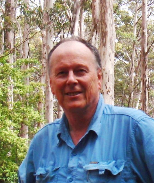
The WalkGPS website is sole-authored by Dave Osborne. Dave is a passionate advocate for bushwalking in WA. He is a Life Member, past-President and past Acting Executive Officer (2017-2023) of HikeWest, WA’s peak not-for-profit bushwalking body; also a Life Member and past-President of Perth Bushwalkers Club; and the author of two popular bushwalking guide books. He launched the original website in 2003 with the simple aim of encouraging anyone who can walk, young or not-so-young, to discover the great wealth of opportunities for enjoyable traditional bushwalking within 100km of Perth city. The website has been expanded in more recent years to include new adventurous walk routes in the state’s South West. (See “In the beginning…” blog post for more about the origins of WalkGPS.)
Non-sponsored
This is a privately-owned non-sponsored site. WalkGPS does not exist to make money and is not an advertiser, promoter or seller of GPS units or guided commercialised walks. The “GPS” in WalkGPS stands for Global Positioning System, not an abbreviation for ‘groups’.
An optional small subscription fee was introduced in 2017 to contribute toward ongoing site running costs and ensure the site is sustainable into the future.
The walks
The 100 walk routes on WalkGPS total over 1500km of bushwalking opportunities which are mostly not documented elsewhere except in part in two books self-published in 2025 (see “Bushwalks of the Perth region” and “Adventurous Walks in WA’s South West”. True to bushwalking tradition, and similar to the bushwalks in that wonderful 1985 book “Forests on Foot…” (Meney & Brown) produced by the then Campaign to Save Native Forests, many of the routes include cross-country (off-track) walking. The majority of the routes were initially explored by myself and not previously published. The walk pages are the product of several thousand kilometres of mostly solo reconnaissance walking; They are not one-off ‘trip reports’, but are based on multiple visits to each of the areas to re-test and optimise every route for walking enjoyment.
Despite the popularity of some routes over many years, the cross-country walking activity in this region has amply proven to be minimum impact and sustainable. The walks are mainly through the mixed jarrah-marri eucalypt forest and wandoo woodlands in the parks and state forests of the Darling Range. Bushwalking is best done in the cooler months from mid-April to late November and especially in spring (September-November) when Western Australia’s unique wildflowers are also at their best and the granite outcrops become richly coloured with mosses, lichens and sundews. The southwestern area of Australia (with the notable exception of the Stirling Range) mainly lacks the dramatic scenery of the more popular walking areas such as the Blue Mountains of NSW, the Tasmanian wilderness or the ‘tramping’ environment of New Zealand, but the beauty of the woodlands, the wildflowers and the granite outcrops of the monadnocks offer the bushwalker their own special rewards.
The walks are all circuit walks, so avoiding any need for car shuffles. There is also mostly no repeat walking of any sections of a walk. The walks cater to a wide range of walker experience and capability. Walk distances for the Perth region day walks mostly range 9 – 18.5km, with the average being 15km. The walks are graded very simply on an Easy-Medium-Hard degree of difficulty scale, but you must exercise your own independent judgment as to whether the walk routes suggested on this site are safe for you taking account of your fitness, training, skills and experience. Importantly, please read the WalkGPS disclaimer before considering any of the walks.
The 1500(+)km of WalkGPS walk routes have been tested and proved popular over the past 15-or-so years by countless independent bushwalkers and members of Perth’s bushwalking clubs. Thank-you to those many keen bushwalkers who have provided such enthusiastic feedback along the way.
Enjoy!
Dave Osborne