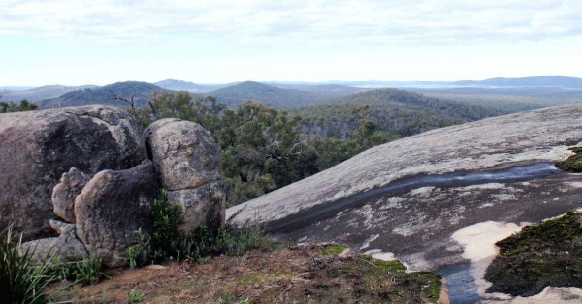
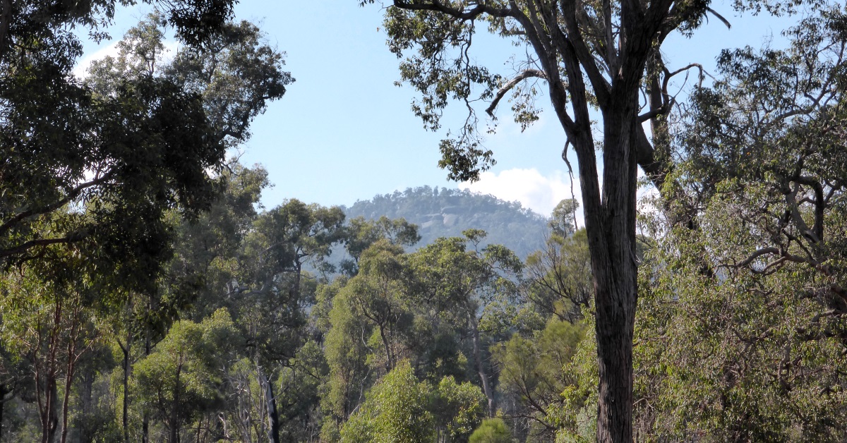
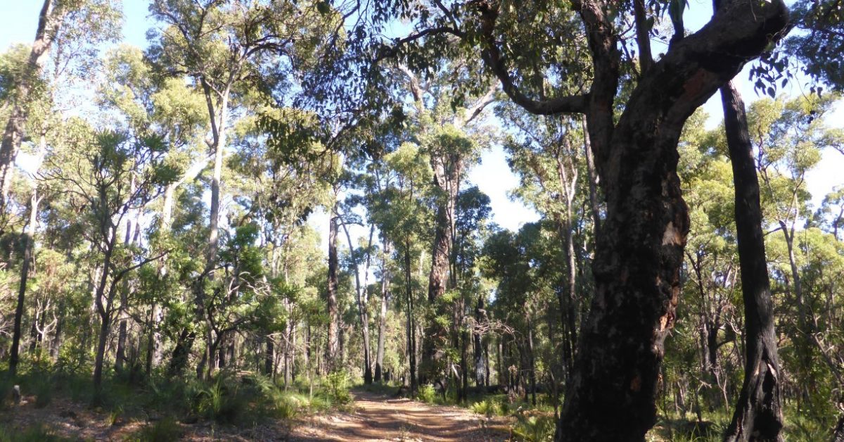
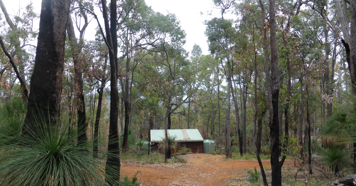
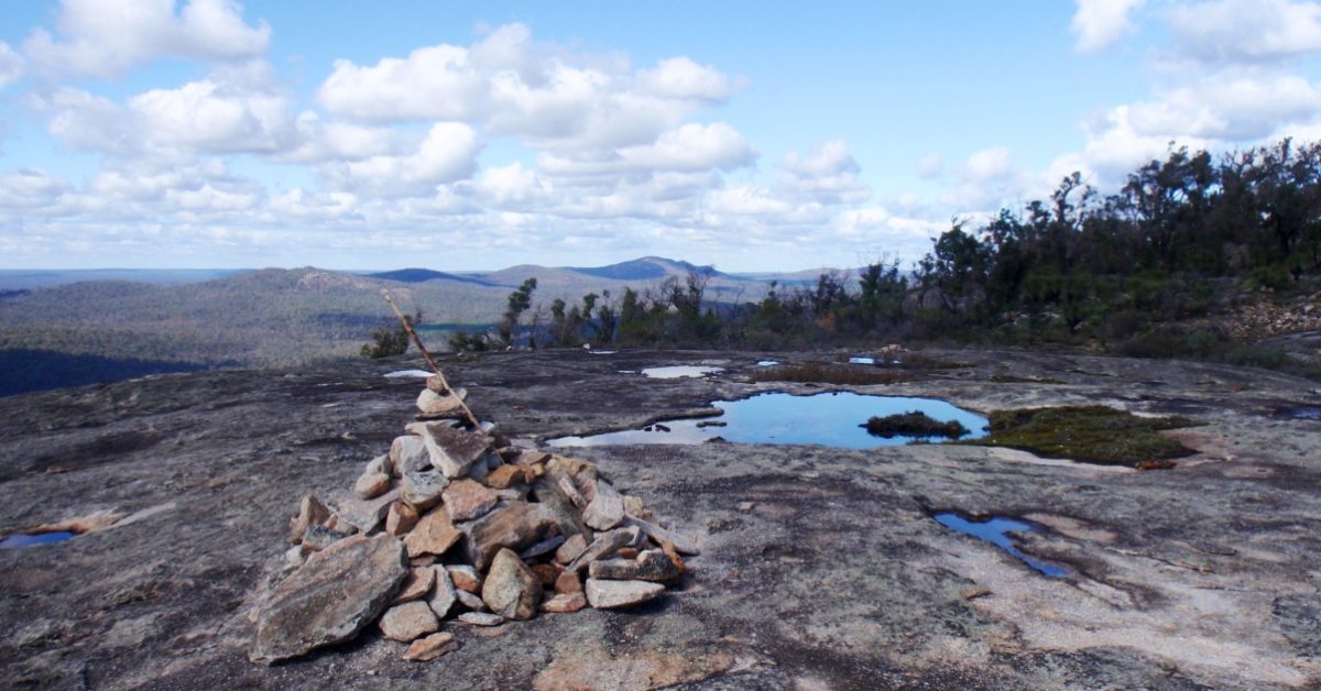
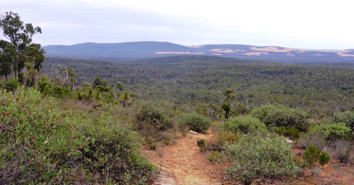
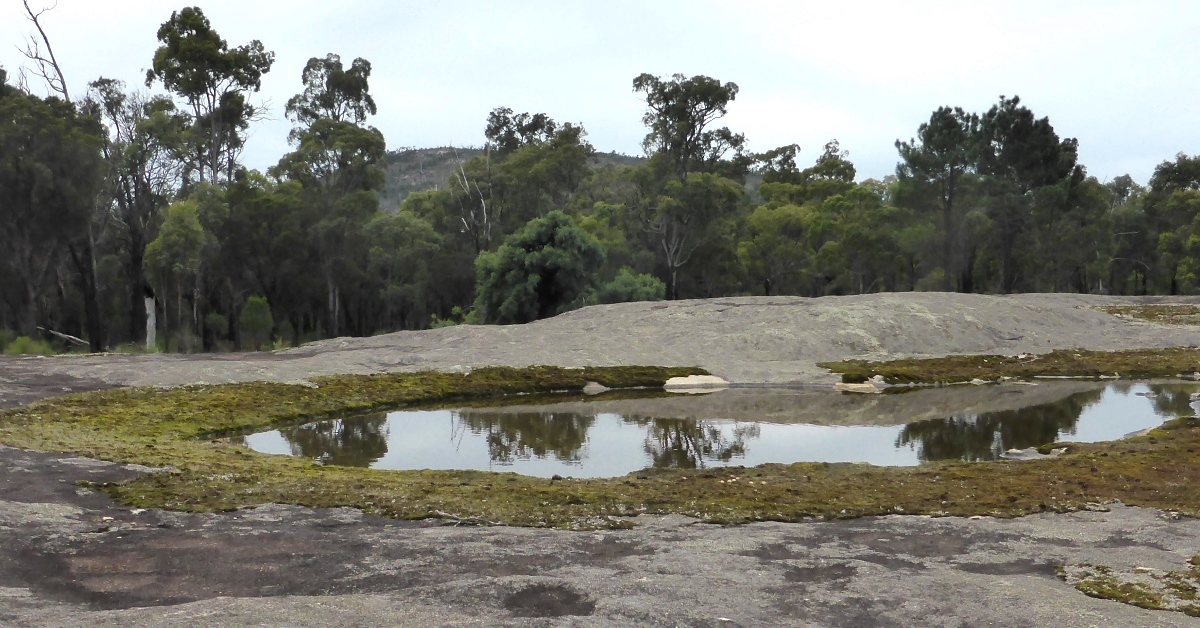
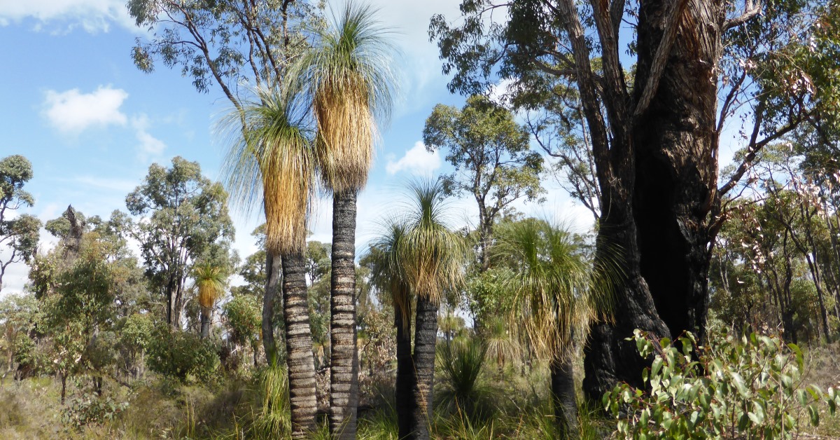
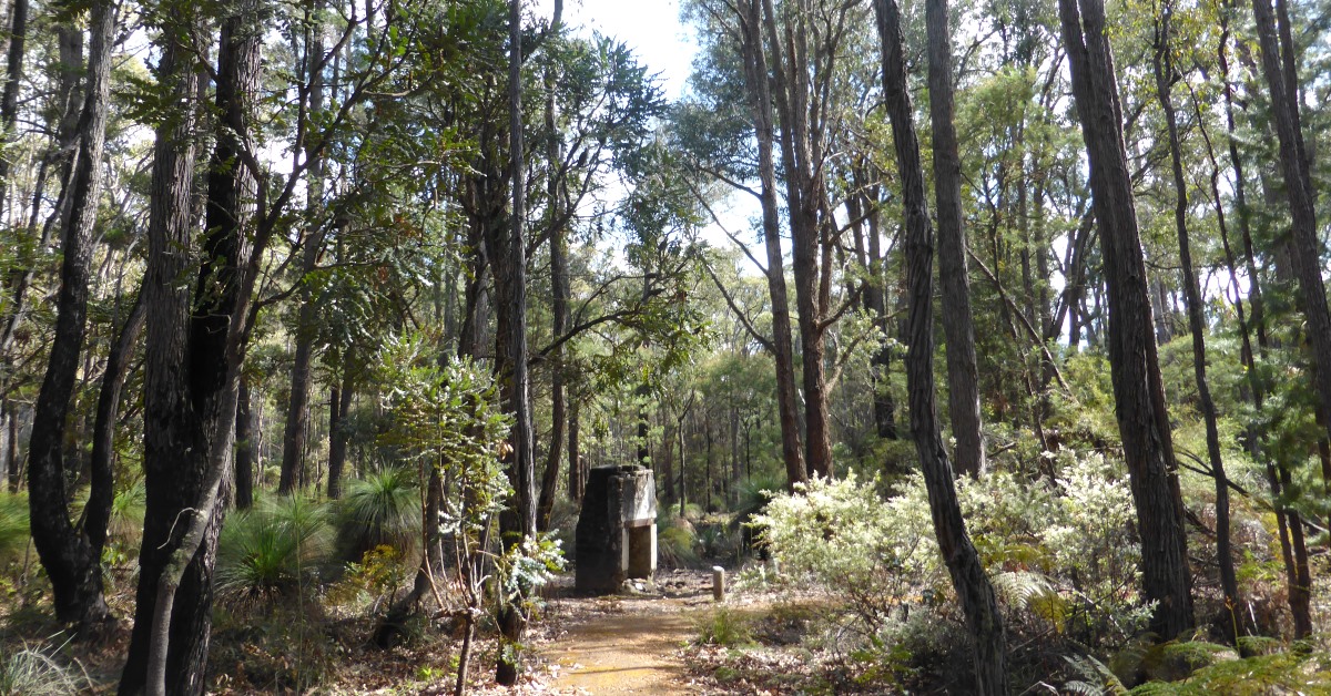
From the start point (at waypoint ‘START’) at the carpark at the historic Balmoral POW Camp walk, follow Balmoral Rd eastward from ‘1’ to the junction with Frollett Rd on the left. Follow Frollet Rd northward for 200m and at ‘3’ veer right to follow Bulldozer Rd (also shared with the Munda Biddi Mountain Bike Trail) NE-ward. After 1km, at ‘4’ locate the entry to an old forestry track on the right. Follow the track eastward for 1.8km to reach a T-junction with a N-S track at ‘5’. Cross the track and continue ENE-ward off-track through quite open forest (mainly mixed jarrah and bull banksia) and soon cross a stream course. Reach an old gravel pit at ‘5-1’ and veer left through heathland to reach a vehicle track at ‘6’. Turn left to follow this old forestry track initially northward. Notice the distinctive stands of grey-white-trunked Bullich (Eucalyptus megacarpa) along the valley floor to the left. The track curves to the right (eastward) after ‘6-1’. Low-lying swampy heathlands can be glimpsed through the forest on the left. At ‘6-2’ the track turns left (NNE) and climbs gently through the forest. After 600m, at ‘7’, veer left (NW) off-track through heathland to reach a nearby small, low granite outcrop at ‘7-1’ which makes a good spot for a rest-stop. Continue NNW off-track to another nearby low outcrop at ‘8’. (Or see Option 1 below for an alternative route from ‘7-1’ to ‘12’ through an impressive forest area.) Then veer right (NNE) and soon ascend through forest to rejoin the forestry track at ‘9’. Veer left to follow the track uphill for ~ 300m. At ‘about ‘10’, or when the track starts curving left (westward), turn right and head off-track northward upslope through mixed forest to reach at ‘11’ 37 Mile Rd (and the Munda Biddi MBT). Follow this minor gravelled road initially NE-ward. At ’11-1’ obtain a good view of the rocky summit of Mt Randall, 2km ENE. The road then curves eastward. Scaffold Rd joins from the right at ‘12’. Continue NE-ward along 37 Mile Rd. Cross a track junction at 37 Mile Rd (the Munda Biddi MBT takes the track to the left) to soon reach Albany Hwy at ‘13’. Cross the Highway and head ENE off-track and initially gently upslope through open forest via ’13-1’ to meet an old forestry track at ‘14’ after 1km. Follow the track ENE. It soon flattens. Turn left at about ’15’ to follow a more recent (2020) roughly bulldozed sidetrack. (Or see Option 2 below to explore a nearby area of interesting large boulders and cave.) Pass around the soil mound at the end of this short bulldozed track and continue northward uphill (via ‘15-1’) through forest that is recovering from a hot prescribed burn in 2020. Try to follow the remnants of an old foot-track which is marked by occasional small cairns. (This popular foot-track was temporarily obliterated by debris from the 2020 prescribed burn.) Pass near the foot of a large, steeply sloping outcrop on the right and at ‘16’ turn left (westward) to climb a small gully between large granite boulders. Turn left again to reach a marvellous vantage point at ‘17’ at the top of the outcrop just below the summit of Mt Randall. The panoramic view to the SSE across Mounts Cuthbert, Vincent and Cooke is one of the best in the Darling Range and you can see the terrain along much of the walk route from this single location. Optionally, make the short climb to ’17-1’ near the boulder-strewn summit area of Mt Randall, from where there is another good view southward. Return to ‘17’ and then walk northward along the outcrop to ‘18’. Then turn right to descend down a short granite rock slope and follow another foot-track NE-ward along a broad ridge. The track is a little indistinct in places though small rock cairns have been placed as occasional markers. It turns eastward at ’18-1’ and continues through open forest, and soon descends via Mt Randall’s eastern ridge. Veer SE at ‘19’ to cross an open, low-lying area bordered by dense shrubland and at ’19-1’ – where the foot-track may be less distinct – pick a way through the fringing shrubland to soon reach at ‘26’ the Monadnocks Campsite (3-sided shelter). Camp here overnight. Next morning, follow the Track generally SE-ward from the campsite. (The Bibbulmun Track is marked by ‘Waugal’ markers, with black ‘serpent’ on yellow background). The track soon crosses an old vehicle track at ’20-1’, then after a further 2.5km reaches the large bald granite outcrop and rock cairn at ‘21’ near the summit of Mt Cuthbert. There are great sweeping views across the eastern Darling Range from here, including to the distinctive, cone-shaped Mt Dale 25km north. The walk route now follows the Bibbulmun Track southward for 3.3km across the summits of Mounts Cuthbert and Vincent. After passing by the summit of Mt Vincent at ~’22’ the Track soon starts a steepish southward descent during which there is a good view of Mt Solus 12km SSW, plus part of ALCOA’s extensive bauxite mining now expanding rapidly across that part of the Darling Range. During the lower part of the descent, soon after re-entering the forest, the Bibbulmun Track bends sharply from westward to SE-ward to follow a spur ridge. At ‘23’ cross an old vehicle track to leave the Bibbulmun Track and head SW-ward along the spur track and across the large Sullivan Rock granite outcrop. Cross Albany Hwy at ‘24’ and cross through the Sullivan Rock carpark, partly following a short foot-track past a historic water well lined with rocks. Locate the signed Balmoral Track trail-head on the western side of the carpark (after ‘25’). (See Option 3 below for a shortened walk option involving an initial car shuffle.) Follow the Track initially generally westward. (The Balmoral Track is marked by ‘bootprint’ markers, on a black background, and in places also by yellow triangles and yellow fluor paint blazes on occasional protruding rocks. Tree branches are also frequently aligned along the track edges to help follow the track where it can become quite indistinct on the often gravelly surface.) After 500m, at ‘26’ reach an old rail formation track. Turn right to follow the form. track NNW-ward for 1km to ‘27’. Then turn left at the trail markers and follow the foot-track westward, soon reaching a gentle outcrop at ‘28’. This is a picturesque spot for a rest-stop in winter and spring, with sizeable rock pools fringed by mosses, and the backdrop of Mt Vincent, 1.75km ENE. Continue generally westward, crossing a forestry track in a valley at ‘29’. The Track crosses further small valleys at ‘30’ and ’30-1’ separated by gentle ridges. Spot the nice grove of tall grass trees along the way. It then descends through mixed jarrah and bull banksia forest to reach Herold Rd at ‘31’. (Note the often hard rocky ground and pea gravel associated with the laterite surface along this part of the track; suggesting this area will be a likely target for the proposed widespread bauxite strip-mining that has been proposed to commence around 2025.) Turn left to follow Herold Rd to its junction with Millars Log Rd at ‘32’, passing another group of tall grass trees on the right. Veer right to follow Millars Log Rd for only 100m to the Track markers on the right at ‘33’. Leave the road here, veering right to follow an old timber rail formation track WNW through tall shrubland and heath flanking the southern bank of 39 Mile Brook. The Track eventually curves left (WSW) and passes through jarrah forest to reach a short branch of Frollett Rd at ‘34’, near another large Balmoral Track sign. Follow Frollett Rd via ‘35’ to the nearby junction with Balmoral Rd and turn right to return westward back to the Start point at the Balmoral POW Camp. Before departing, have a wander around the historic camp on the 500m loop trail (see Other info.) to learn a little of the interesting history of this camp.
Option 1, Alternative route from ‘7-1’ to ‘12’ through an impressive forest area: Instead of continuing to ‘8’ etc after ‘7-1’, return to the track at ‘7’. Cross the track and head eastward uphill to meet another forestry track at ‘8-ALT’ after ~200m. Turn left to follow the track initially ENE-ward (notice a large marri on the left of the track at ‘LGE-MARRI’ and large jarrah nearby to the right). After 700m the track turns northward to join Scaffold Rd at ‘9-11ALT’. Follow Scaffold Rd to rejoin the described route at ‘12’. This option is slightly shorter than the described route and passes through some very nice forest, but bypasses the good view to Mt Randall.
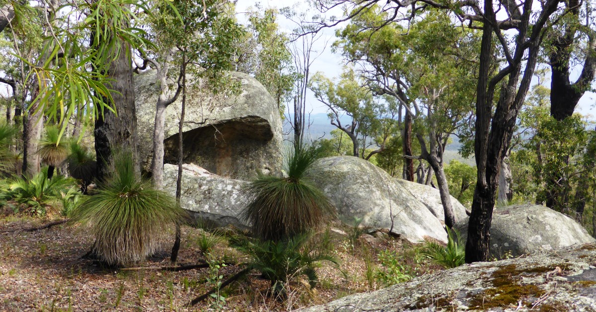
Option 2, Short detour to large boulders NE of ‘15’: Instead of turning left at ‘15’ you can opt to veer NE off-track to reach a cluster of tall ‘sentinel’-like rocks including the striking ‘Fang Rock’ within 200m. Then head WNW roughly toward ’15-1’ and look for another large rock cluster and investigate the cave below one of the rocks. Rejoin the main route at about ’15-1’. This very worthwhile small off-track diversion doesn’t significantly add to the total walk distance. This is a popular area with boulderers.
Option 3, Shortened (19km) walk option: Groups can do a car shuffle at the start of the walk to leave a vehicle at the east end of the Balmoral Track, at the Sullivan Rock carpark to either reduce the walk distance by bypassing the Balmoral Track and/or to offload backpacks before commencing the final 10km along the Balmoral Track. See Directions notes.