Mount Randall Walk overview

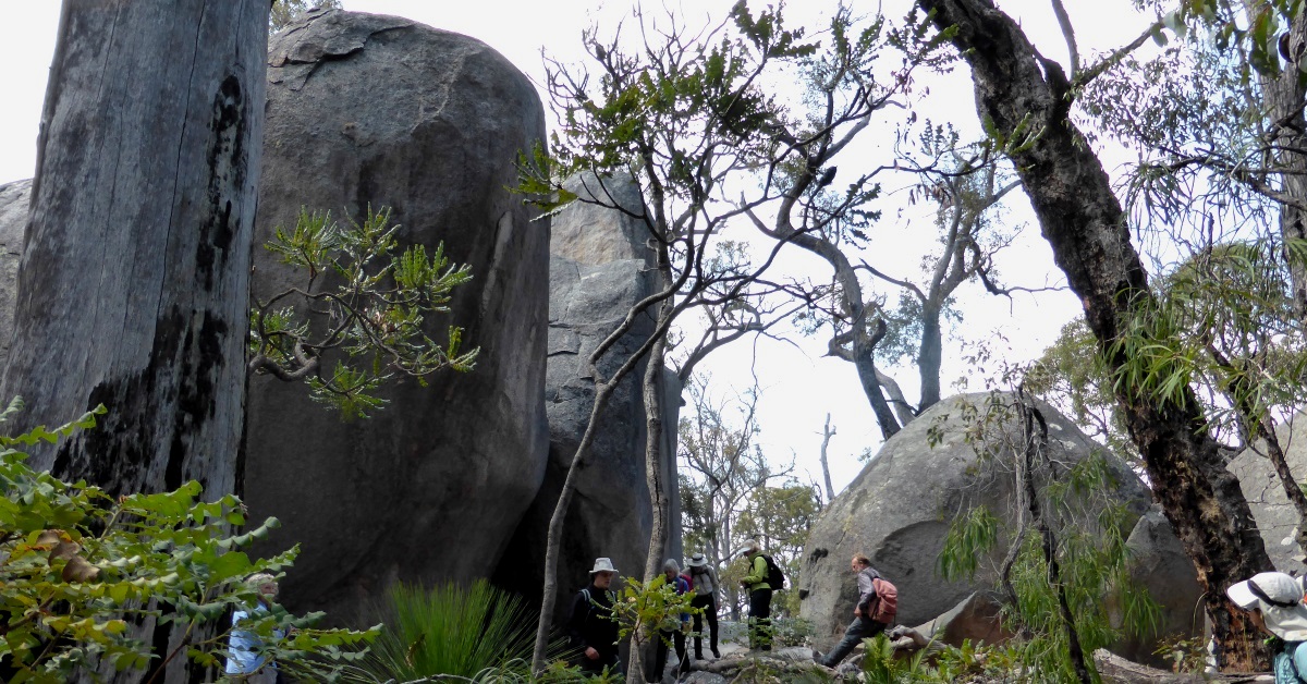
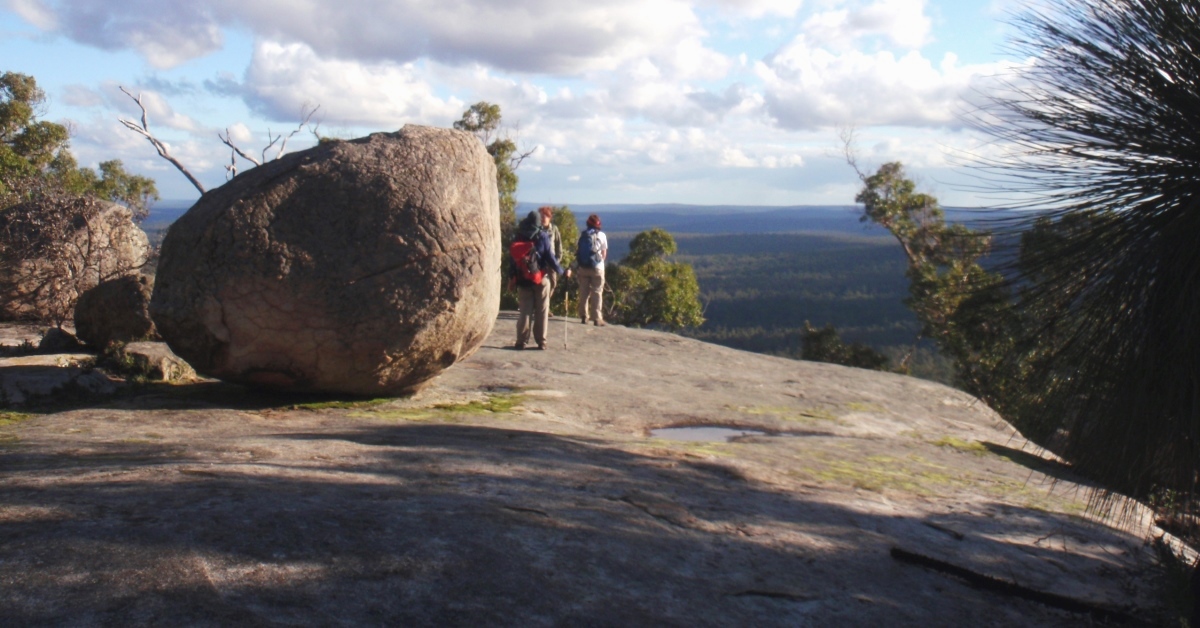
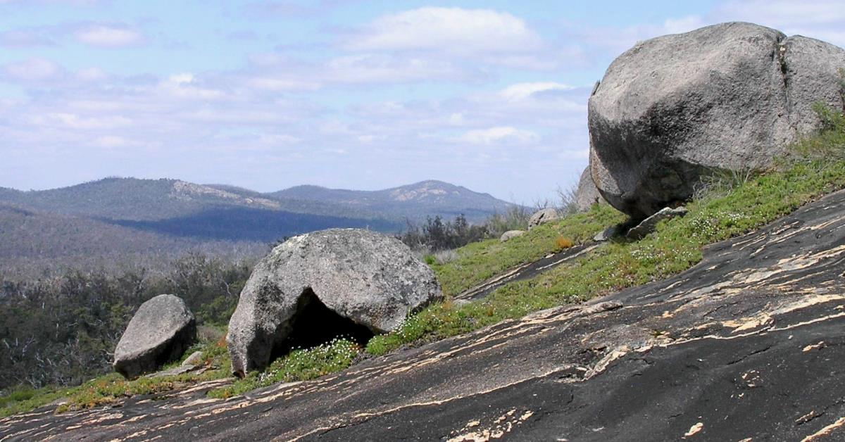
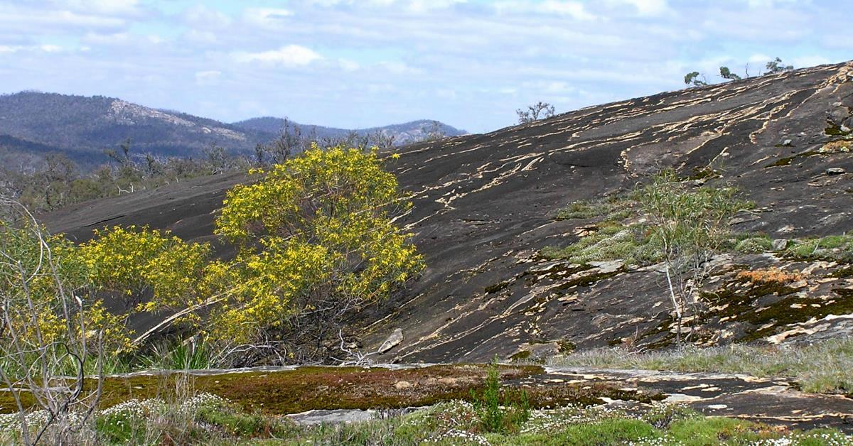
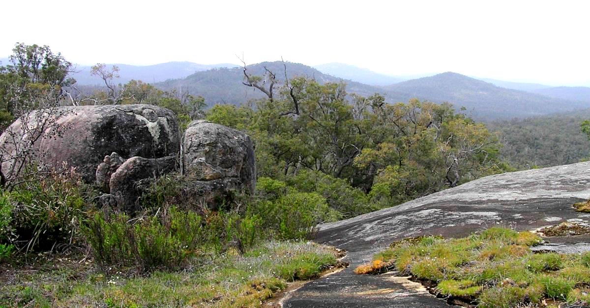
This mostly off-track walk includes an ascent of Mount Randall with its great view southeast to Mounts Vincent, Cuthbert and Cooke. It also visits some less explored parts of the Monadnocks Conservation Park to the north and northeast, including several large sloping granite outcrops, with more good views. The walk partly overlaps (2.8km) with the Three Mountains – Randall, Cuthbert, Vincent Walk.

  • Main features / Highlights

    This walk within the Monadnocks National Park includes an ascent of Mount Randall (summit elevation 523m) with its great view of Mounts Vincent, Cuthbert and Cooke to the SE. Apart from Mount Randall it features several large sloping granite outcrops to the east and north which provide more views east across the Darling Range and NNE to distant Mount Dale. The route visits the Monadnocks Campsite but includes less than 300m walking on the Bibbulmun Track. A worthwhile, optional visit also to the nearby Alyi-wa Miya Group Campsite adds less than 1km to the total walk distance. Between the outcrops, the walking is mainly easy, through open jarrah (-marri) forest with balgas, and some tall grass trees, sheoak and banksia, plus a few possible short scratchy sections of parrot bush around the outcrops. The uphill sections aren’t demanding and the walk can be taken at a leisurely pace. In wet weather extra care is needed on the outcrops which can become slippery in places.  The walk partly overlaps (2.8km or 20%) with the Three Mountains – Randall, Cuthbert, Vincent Walk. It also overlaps 20% with the Two Mountains – Randall, Cuthbert Walk which is similar length but more challenging, with more uphill walking and scrambles.

    For overnighters: For those keen to camp overnight in the area: The Monadnocks Campsite (which includes a 3-sided shelter; at waypoint ’18’) on the Bibbulmun Track is located after the initial 3km of the walk.  See Nearest campsite/s below for more info.

  • Route notes

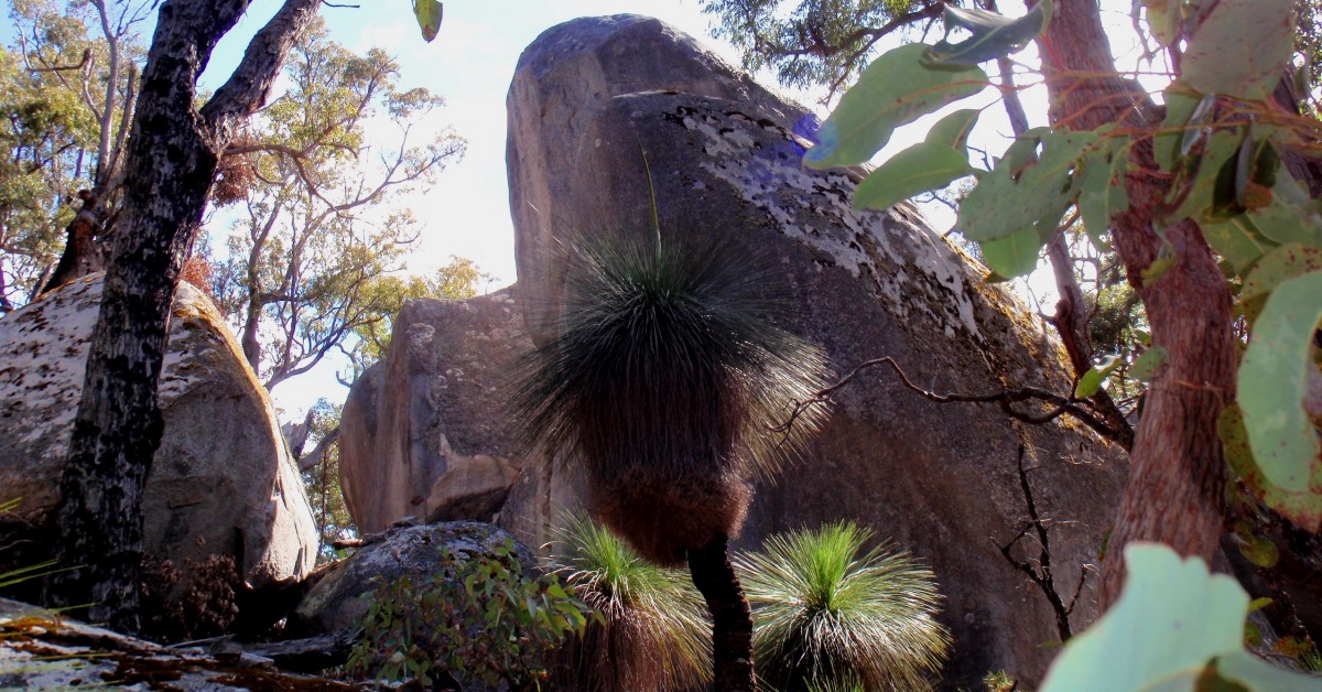
    From the start point (at waypoint ‘START’) walk 200m back up 37 Mile Road (old vehicle track) and cross Albany Highway at ‘1’. Head approx. ESE off-track through open forest up a gentle slope via ‘2’ and onto a broad, flat area of a spur ridge on the southwest flank of Mount Randall. Veer left (ENE) at ‘3’ and climb the steepening hillside. Veer right (eastward) at ‘4’ and meet an old vehicle track at ‘5’. Turn left to follow the track initially steeply uphill. You may notice the remnants of a minor foot-track to the left at ‘5-1’ (once marked by a small cairn opposite but has since been knocked down during prescribed burn operations in 2020 which also obliterated parts of this old foot-track and have made it temporarily difficult to follow.) Continue along the vehicle track to ‘6’ , then veer NE off-track a cluster of tall ‘sentinel’-like rocks at  ‘7’, which include the striking ‘Fang Rock’ (informal name). Then head westward to another large rock cluster at ‘8’ and investigate the cave below one of the rocks. This rock cluster is also a popular area with boulderers. Continue WNW to meet the old (currently indistinct) foot-track at ‘9’. Head northward uphill, following the foot-track where possible, assisted by the occasional small rock cairns along the route. Soon after ‘9-1’ pass the foot of a large, steeply sloping outcrop on the left and at ‘10’ turn left (westward) to climb the flank of the outcrop. Turn left again at ‘11’ to reach a marvellous vantage point at ‘12’ at the top of the outcrop just below the summit of Mount Randall. The panoramic view to the SSE across Mounts Cuthbert, Vincent and Cooke is one of the best in the Darling Range and you can see the terrain along much of the walk route from this single location. For a quick exploration of the actual summit area, head SW upslope to the southern area at ‘13’. The outcrops and large boulders around the summit are popular with rock climbers. (CAUTION: Dense, scratchy  Parrot Bush becomes re-established among the boulders in the summit area in the periods between DBCA prescribed burns, eventually making passage difficult and unpleasant until the next burn opens the area up again. If the Parrot Bush appears too dense to allow an enjoyable summit visit, simply bypass the summit area by returning back along the outcrop from ’12’ and continuing northward direct to nearby ’15’ to resume the described route from there.) Explore a little around the southern area to get the best of the view south, then head northward to ’14’ near the northern end of the summit area. Again explore a little to get the views NW-ward and to Eagle Hill, 5.5km to the north. You will also see the old fallen metal tower of a former surveying trig. station among the rocks and sweeping views, including northward to Eagle Hill. Then veer eastward and descend from the summit area to ‘15’. Descend the short rock slope to locate the start of a  foot-track. The track becomes easier to follow after about ‘15-1’. It continues through open forest, initially across a very broad nearly flat area of Mt Randall’s eastern spur ridge, then descends eastward via ‘15-2’. At ‘16’, cross an open, low-lying area bordered by dense shrubland and at ‘17’ – where the foot-track may be less distinct – pick a way through the fringing shrubland to soon reach the Monadnocks Campsite (3-sided Bibbulmun Track shelter) at ‘18’. This is a good spot for a rest break. Follow the Track from the campsite via ‘18-1’ and ‘18-2’  (The Bibbulmun Track is marked by ‘Waugal’ markers, with black ‘serpent’ on yellow background), then at ‘19’ veer left (ESE) off-track and gently upslope through fairly open, mixed jarrah-marri-banksia forest. After about 100m, cross a spur track off the Bibbulmun Track. (Optionally, turning left to follow this spur track would lead in 350m to the Alyi-wa Miya Group Campsite which offers nice views across the forest to the northeast. This worthwhile return side trip to the campsite would increase the total walk distance to around 13.5km.) Cross a narrow ridge at ‘19-1’ and descend southward via ‘20’ through a small area of interesting outcrops and large boulders. Continue southward via ‘21’ to re-cross the narrow ridge top and descend to a westward-sloping rock slab at ’21-2′ at the head of a small side valley. Re-enter the forest at ‘22’. Continue south to SE-ward around the hillside via ‘23’. At ‘23-1’ descend a SE-sloping outcrop via ’24’. Cross heathland and scrub below the outcrop  ‘24-1′, then veer NE-ward at ‘25’ through scratchy shrubland to descend to an outcrop at ‘26’. The route now follows the upper part of this long eastward-sloping outcrop northward for about 450m (via ’26-1′, ’26-2’ and ’26-3’,  and ’27.’ Pass a large boulder at ‘26-3’ and then descend eastward down the 80m high sloping granite slab via ‘27’, ‘27-1’, and ‘27-2’.  Reach the foot of the outcrop at ‘28’ and re-enter open forest at ‘28-1’. ‘Contour’ north to NW-ward around the gentle hillside via ‘28-2’, 28-3’ and ‘28-4’. Veer westward along a gully via ‘29’ and ‘30’, to reach another eastward sloping outcrop at ‘31’.  Head northward and then NW through forest and across yet another eastward-sloping outcrop via ‘32’, ‘32-1’, ‘33’, and ‘34’, again mostly ‘contouring’ around the hillside. Cross a small gully at ‘35’ and continue WNW around the hillside through forest via ‘35-1’ and ‘36’. Then veer further westward to reach the Bibbulmun Track at ‘37′. Turn right to follow the track NW to ’38’. Then veer to the left, off the track through the forest via ’39’ to cross a small stream at ‘40’ and reach the foot of another sloping outcrop. Partly ascend the outcrop and walk along slope NW to ‘40-1’. Then continue upslope, following an animal track to pass through a short scrubby section back onto open outcrop. At ’41’ veer sharp left to head southward to the upper edge of the outcrop at ‘41-1’. Continue southward, initially along slope through mixed forest, heath, and across partly rocky terrain to reach the crest of a narrow ridge at ‘42’. (This is the northern ridge of Mount Randall.)  Follow the ridge SSE via ’43’, then at ‘44’ veer more southward, initially downslope. Cross a small gully and then a small spur ridge at ’45’.  Cross a stream course at ’46’, then veer right to head SW along slope.  After ‘48’ descend to cross a narrow gully at ‘49’. Then continue WSW to SW-ward, mostly gently downslope through open forest via ‘50’ and ‘50-1’ to re-cross Albany Highway at ‘51’ to get back to the start point along 37 Mile Road.

  • Access / Directions

    29km SE of Armadale along  Albany Highway and 3.8km after Jarrahdale Road junction  on left, turn into 37 Mile Road (a vehicle track) on the right indicated by a small (easily missed) sign on left side of Albany Highway. Park on the side of that track (at waypoint ‘START’ point) about 200m from the Highway. This is a good secluded parking spot, preferable to parking at the side of the Highway itself. (For car turning space along the narrow track, continue for a further 150m to the signed intersection of 37 Mile Road with Redgum Road.)

    Google Map

  • Nearest campsite/s

    Monadnocks Campsite: On Bibbulmun Track. This campsite is also on this walk route (at waypoint ‘18’).

    NOTE: Bibbulmun Track sleeping shelter restrictions –  Check Overnighting on WalkGPS for info. on access to the Track shelters, especially if planning an overnight or multi-day walk for a group of 8 or more walkers.

  • Escape route/s

    West to Albany Highway.

    Or north via Bibbulmun Track to intersection with Randall Road (forestry track), then turn left to follow Randall Road to reach Albany Highway.

    Or south via Herold Road (old vehicle track) to reach Albany Highway.

  • Other Info.

    “Monadnocks Conservation Park”, DBCA – Parks and Wildlife site – Unfortunately this provides no significant information and no management plan appears to exist for the Park as yet.

    “Bibbulmun Track, Guidebook 1, Darling Range”2014 edition.

    “Perth Rock Climbing Guide”, Climbers’ Association of W.A., 2010 (2nd ed.) – Includes a climbers’ perspective of Mount Randall.

    Trivia: What is a “monadnock”? (Click on link for answer.)

    Other map availability

    South West WA 25K Scale Topo Maps”, Greg Harewood & Landgate, 2015.  – Digital raster; ECW format on 16GB USB. See tiles #301-2133-III-NE and #306-2133-II-NW for relevant map coverage.

Back to top