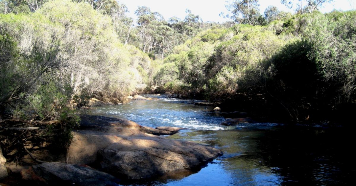
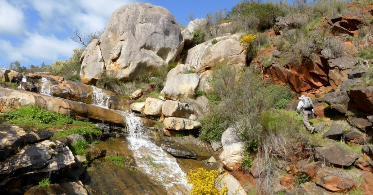
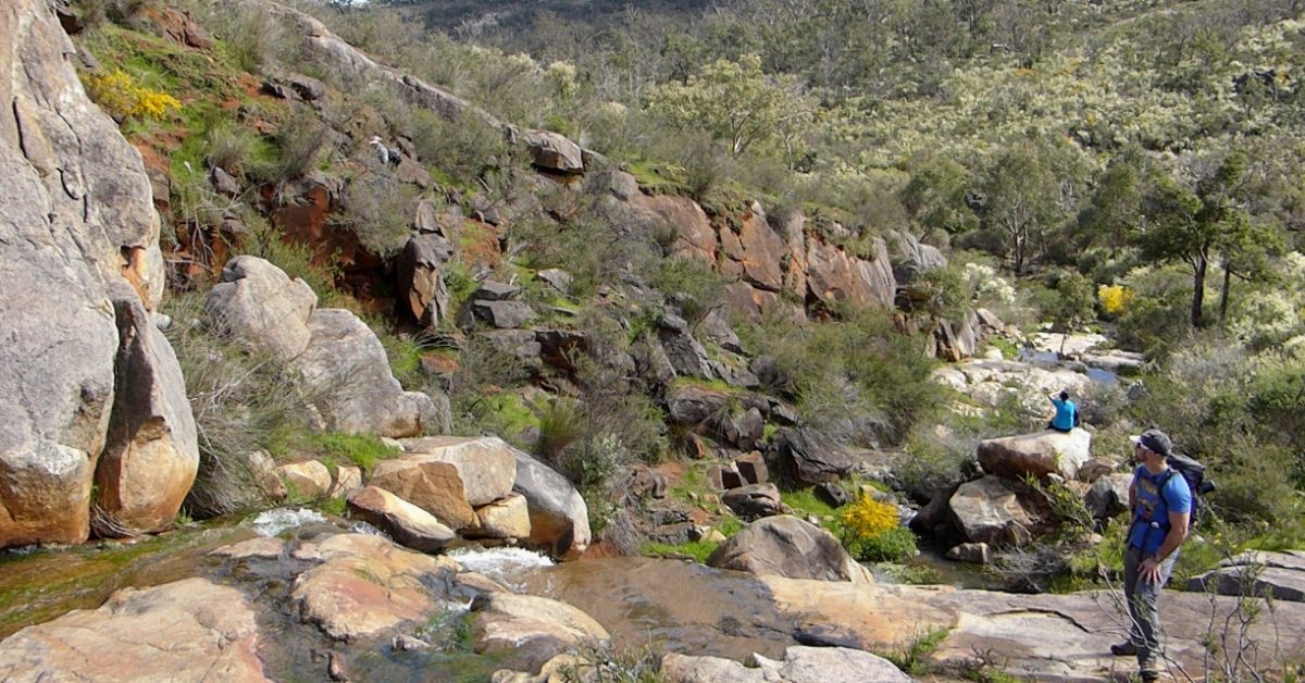
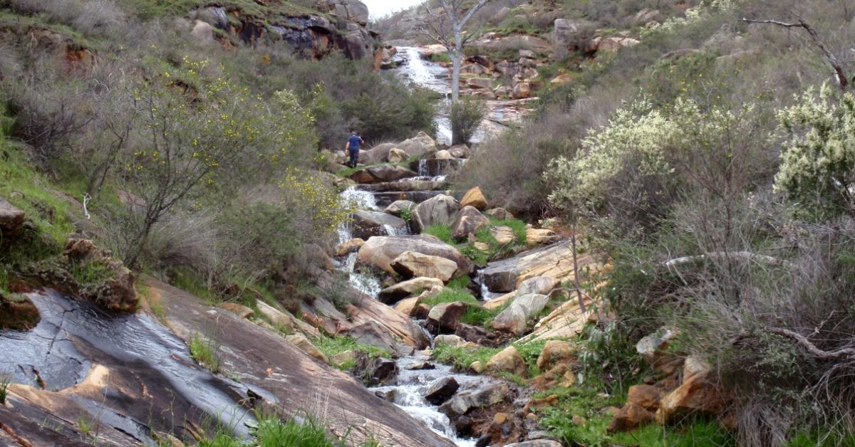
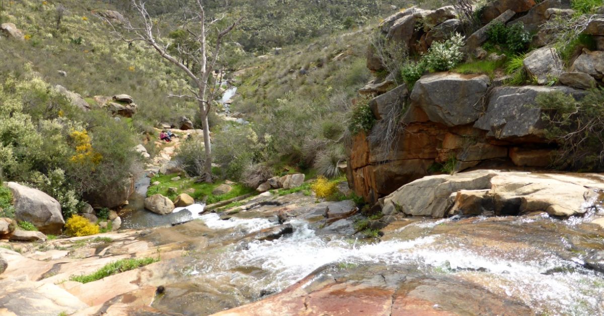
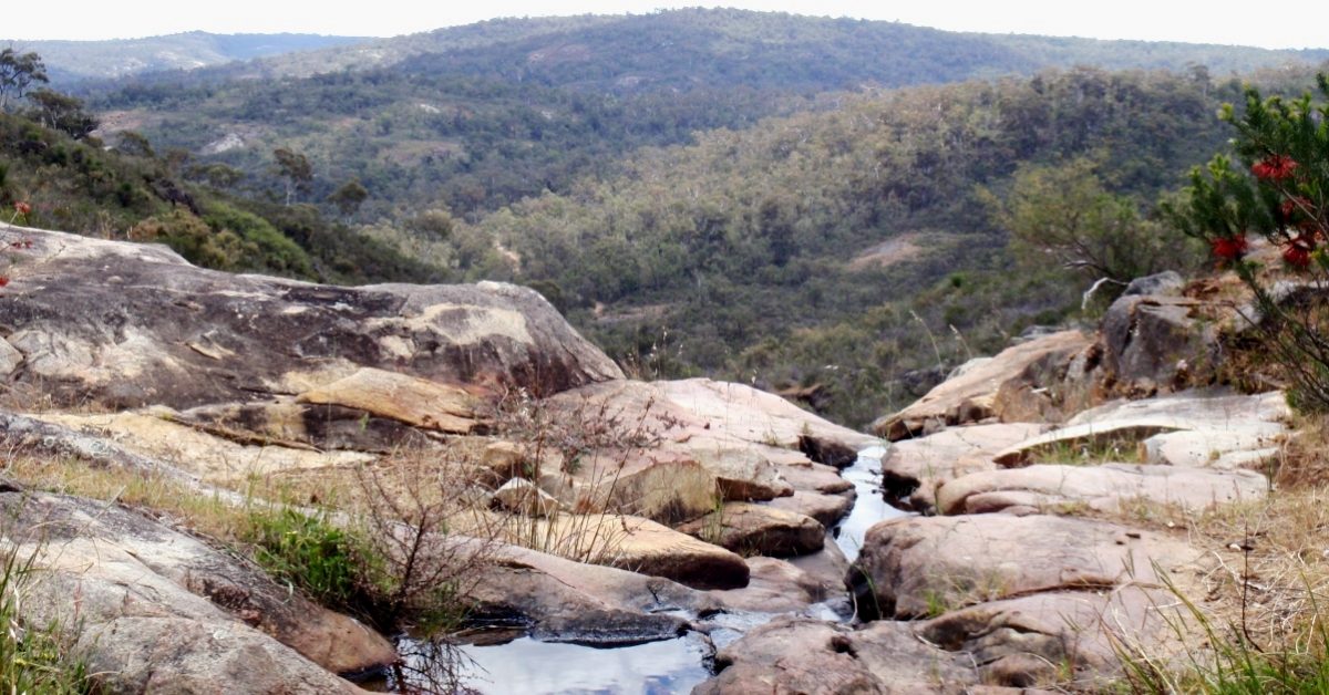
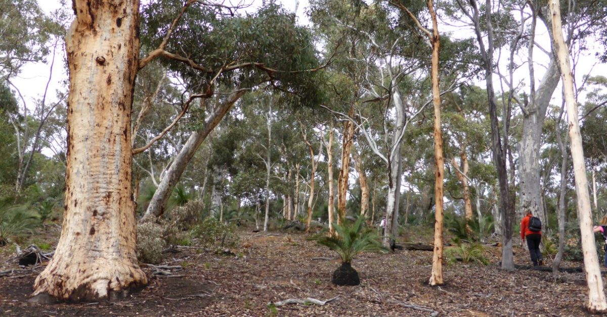
Wooroloo Brook drains a sizeable catchment area (536 sq km) and during a wet winter it flows quite swiftly in its lower few kilometres, dropping about 50m overall as it passes through its narrow, quite rugged valley westward of the bridge at O’Brien Road (Gidgegannup) to its confluence with the Swan River in Walyunga National Park near the western edge of the Darling Range. The walk is centred around this lower section of the Brook.
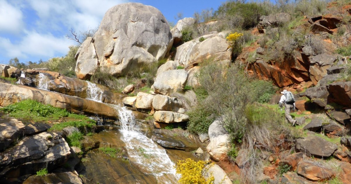
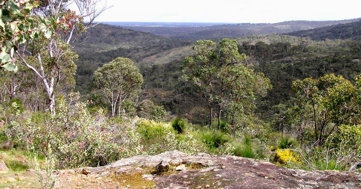
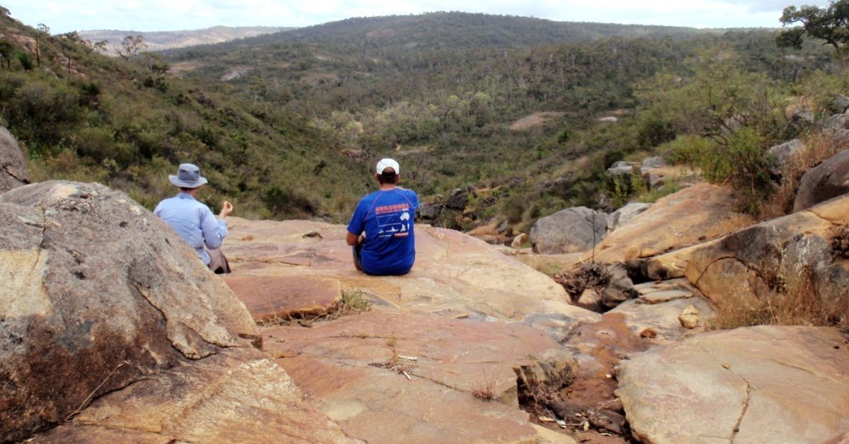
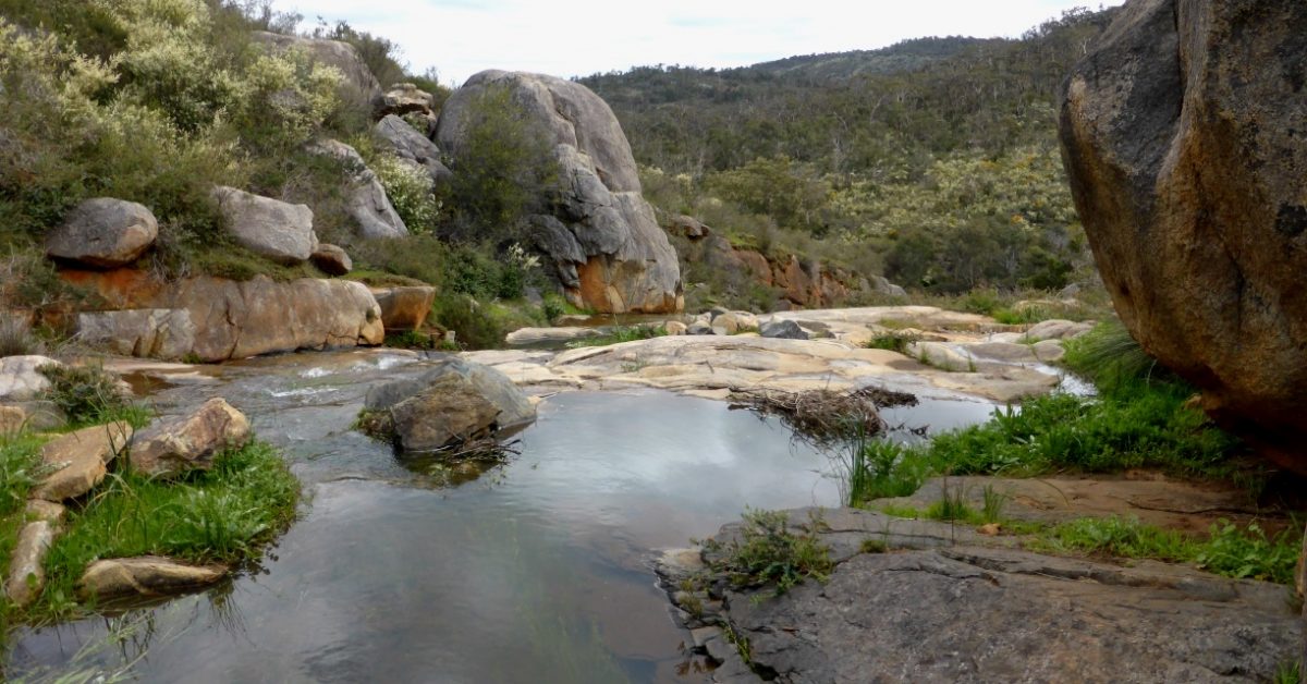
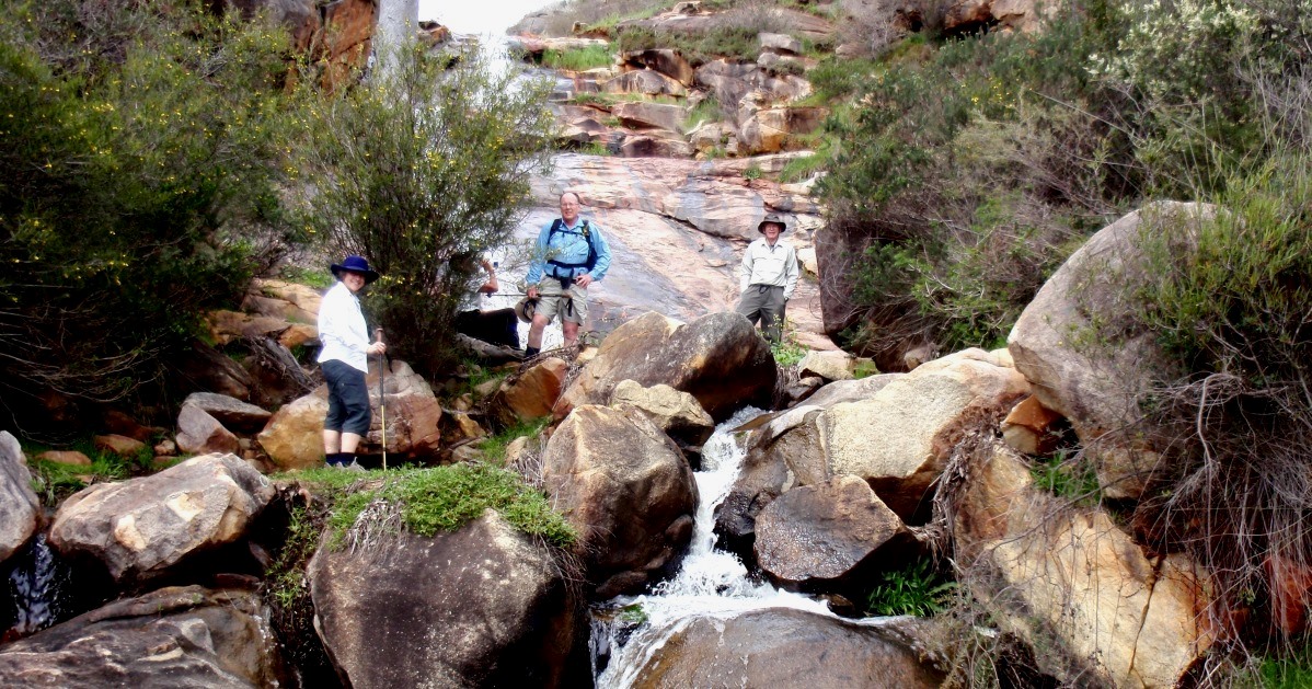
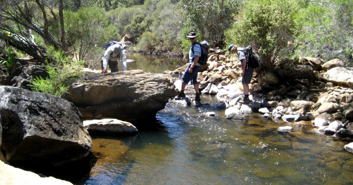
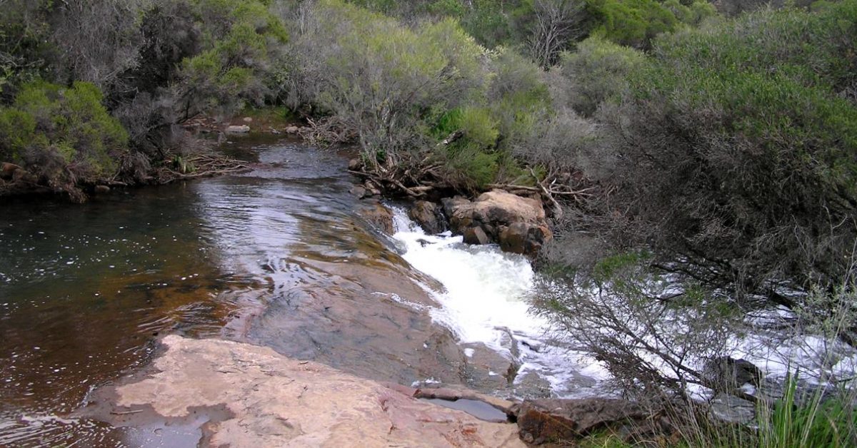
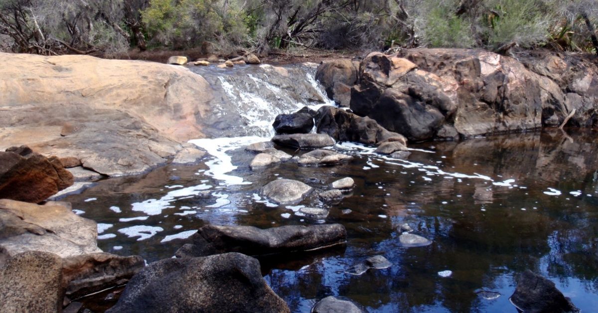
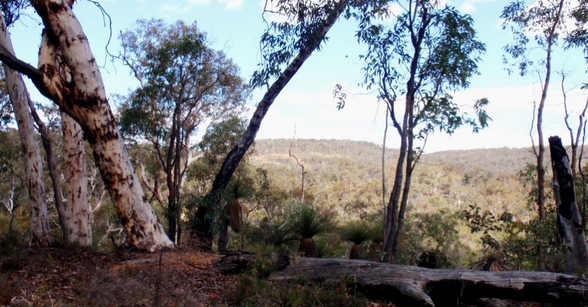
This is a very rewarding walk route which provides plenty of variety and some small challenges for the keen walker; These include the steepish (in places gorge-like) valley sides which require some energetic uphill climbs, and also three crossings of the Brook which usually can’t be achieved without getting your boots and/or feet wet! The hill climbs also provide many excellent sweeping views across and down the valley to the Coastal Plain and along the Swan River valley. A short optional but very worthwhile diversion involves a scramble up a rocky side gully where small waterfalls should be on display in winter.
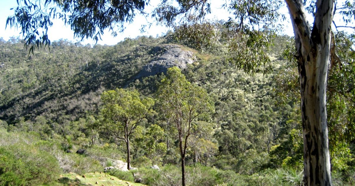
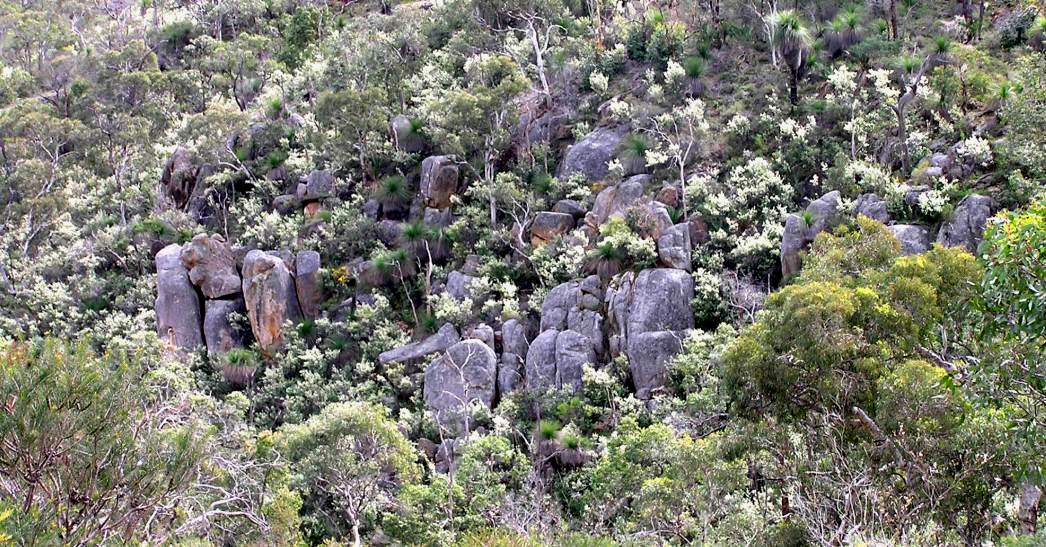
The walk includes only short off-track sections because much of the valley slopes and the banks of the Brook are blanketed in quite dense shrublands which can make off-track walking in the area very frustrating and difficult, though the route does include one short section as a sample! –The shrublands include Trymalium sp. (similar to Karri hazel), Calothamnus sp. (One-sided bottlebrush), and various Grevilleas, Hakeas and Melaleucas etc. These might be a challenge to the off-track bushwalker, but in spring they offer a rich and varied wildflower display. Apart from the extensive shrublands the walk route also passes through mixed jarrah, marri and wandoo forest on and around the hill tops, and through heathlands surrounding the scattered granite outcrops. Sadly, along the banks of Wooroloo Brook, as occurs along many other rivers and streams near the Darling Scarp, the invasive pink- to red-flowering weed Watsonia is gradually taking over areas previously occupied by native vegetation.
The western one-third of the walk area lies within Walyunga National Park whereas the remainder is within land reserved for ‘parks and recreation’ (as part of Darling Regional Park) under the Metropolitan Region Scheme. Parts of the reserved land were privately-owned but are now not actively farmed. (The walk bypasses the western end of Valley Farm (off O’Brien Road) which is not reserved land and is actively farmed.)
Some off-track sections of the walk route have become very dense and scratchy as the vegetation regenerates following a major bushfire which burnt through the region in Feb. 2021 (see also Alerts/Issues and Comments).
Together with the Avon Valley National Park and Paruna Wildlife Sanctuary to the NE, Walyunga National Park is an important area for native fauna conservation along the Swan-Avon Valley. Animals re-introduced by DBCA/AWC include the tammar wallaby and black-flanked rock wallaby. In recent years however, in the absence of serious culling, feral goats have reached damaging, plague proportions.
Alternative easier walks:
To avoid off-track section – The main walk is relatively short and not difficult for a fit and experienced bushwalker, but others may prefer to avoid the off-track section (between ‘7’ and ‘9’). That can be easily avoided by commencing the walk route in the reverse, anti-clockwise direction via waypoint ‘50’, ‘49’ etc around to ‘19′ and then following the good track up the hill from waypoint ‘19’ to rejoin the ridge near ‘38′. Then retrace the route from there back to the Start point.
To avoid crossing the Brook – If the Brook happens to be high and/or fast and unsafe to cross when you visit (see Alerts / Issues) you can follow the Option in the Route notes below which allows all three brook crossings to be safely bypassed, but adds 3km to the total walk distance. Other options are easily possible by commencing the walk route in the reverse, anti-clockwise direction and later using some combination of the alternative tracks during the return leg.
Walyunga Lookout extension – If you opt to avoid the river crossings as above, you could also vary the route to link into part of the eastern section of the Walyunga NP Walk route (to Walyunga Lookout) in the NW via ’28A’ and/or ‘26’.
Alternative combination with part of Walyunga NP Walk: Western parts of the Wooroloo Brook walk can easily be combined with eastern parts of the Walyunga NP Walk, by starting at either:
– Boongarup Pool carpark in Walyunga NP – then cross the Swan River via the nearby ford and follow the vehicle track to cross the railway tracks, etc, and link into the walk at ‘23’ via the track up the Wooroloo valley); or,
– Walyunga Lookout carpark at end of Ewing Rd in the north (off O’Brien Rd) – then link into the walk at ‘26’ or ‘28A’.
The eastern part of the walk route can then be bypassed by following a vehicle track up/down the hill between ‘19’ and ‘38’.