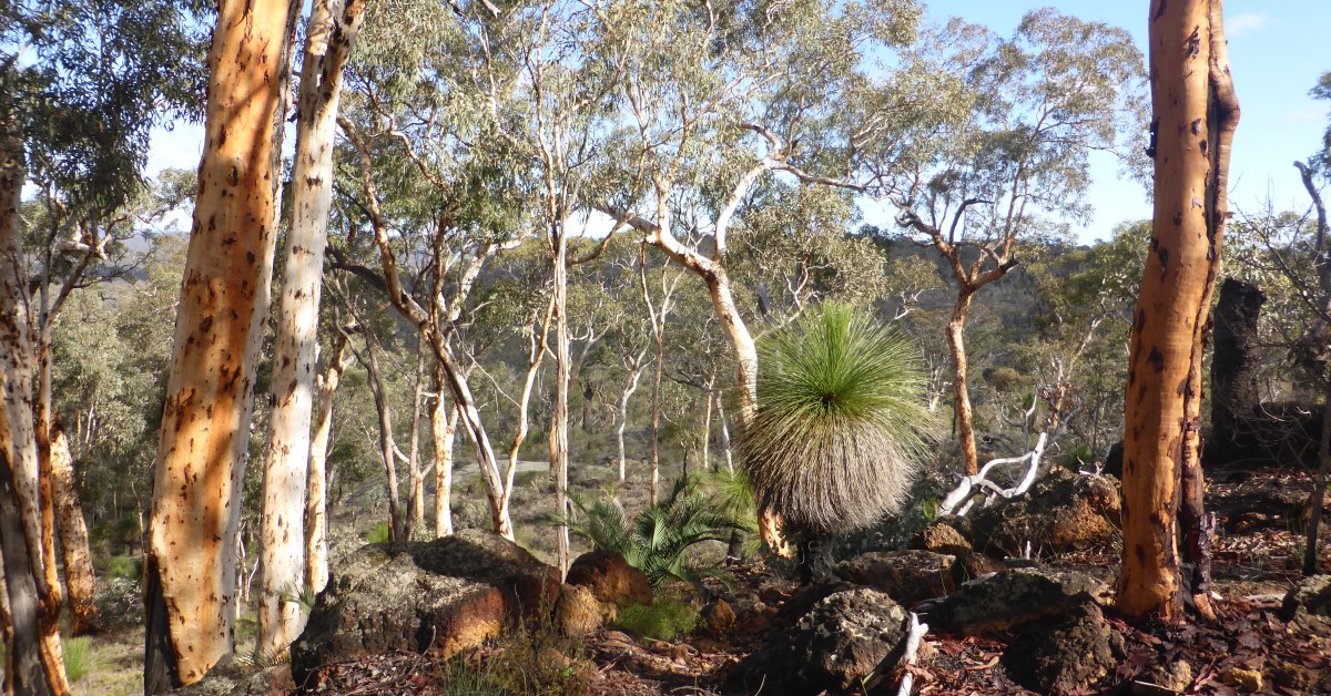
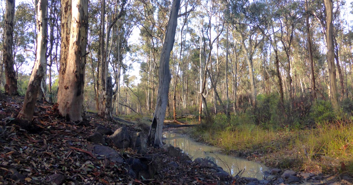
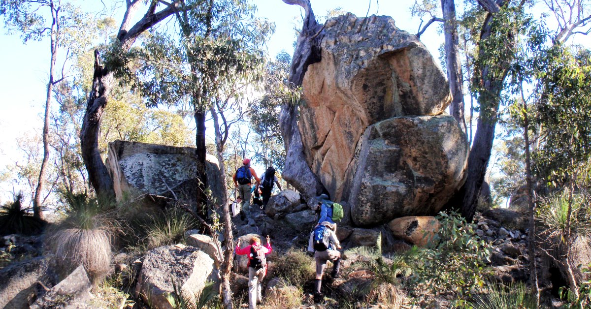
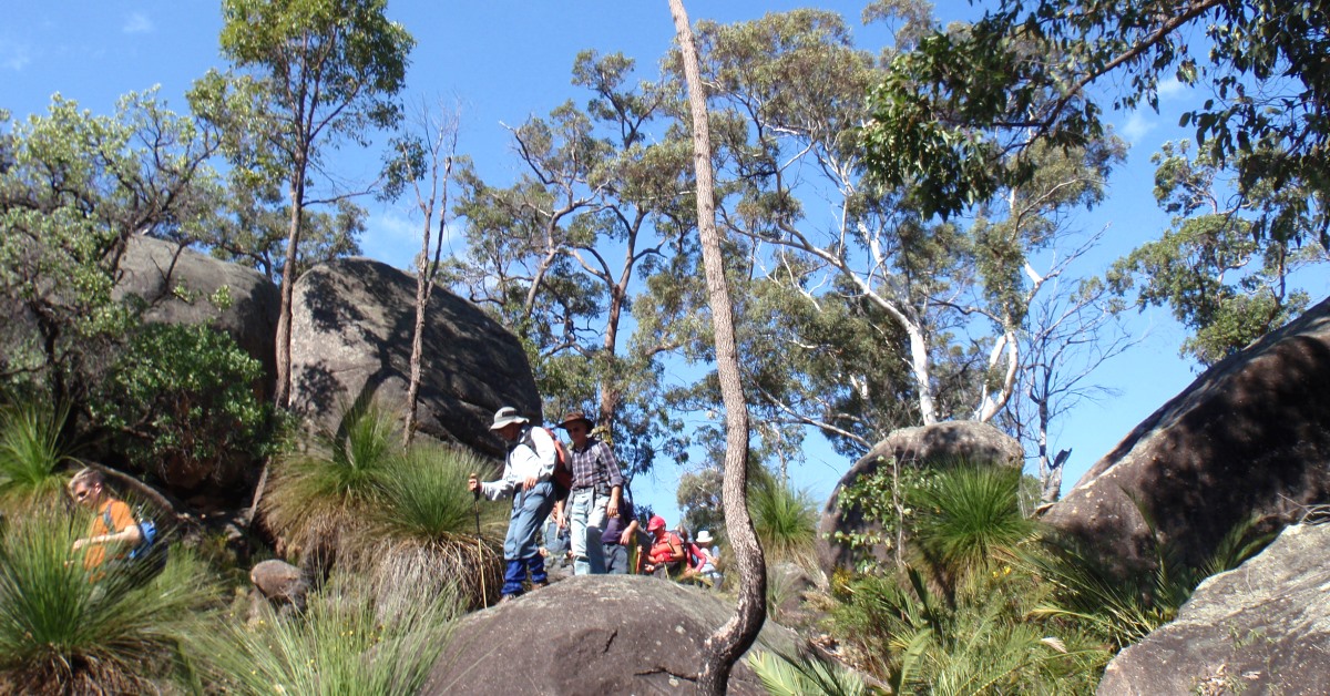
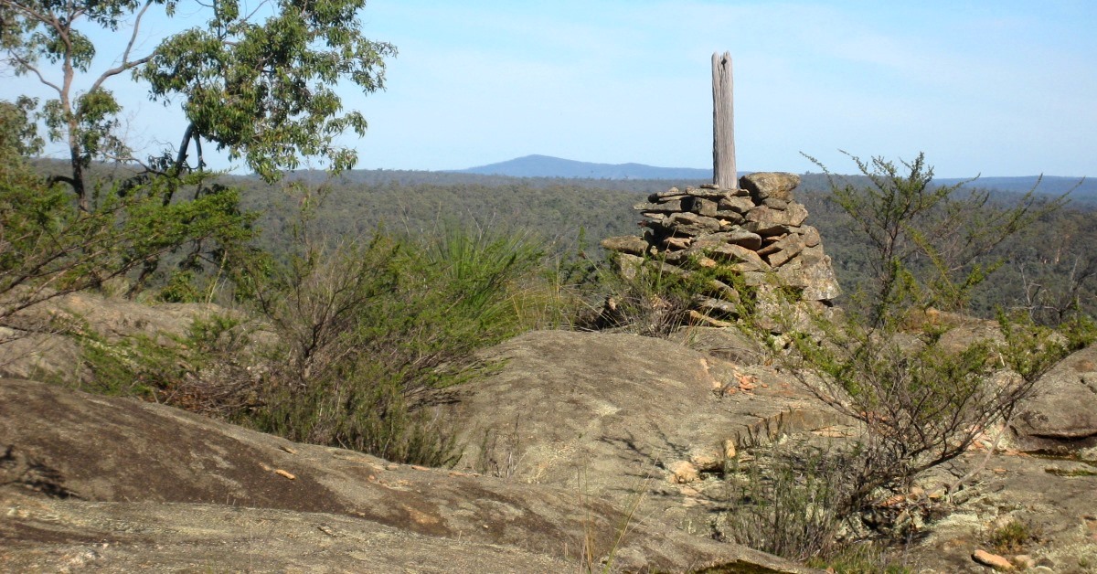
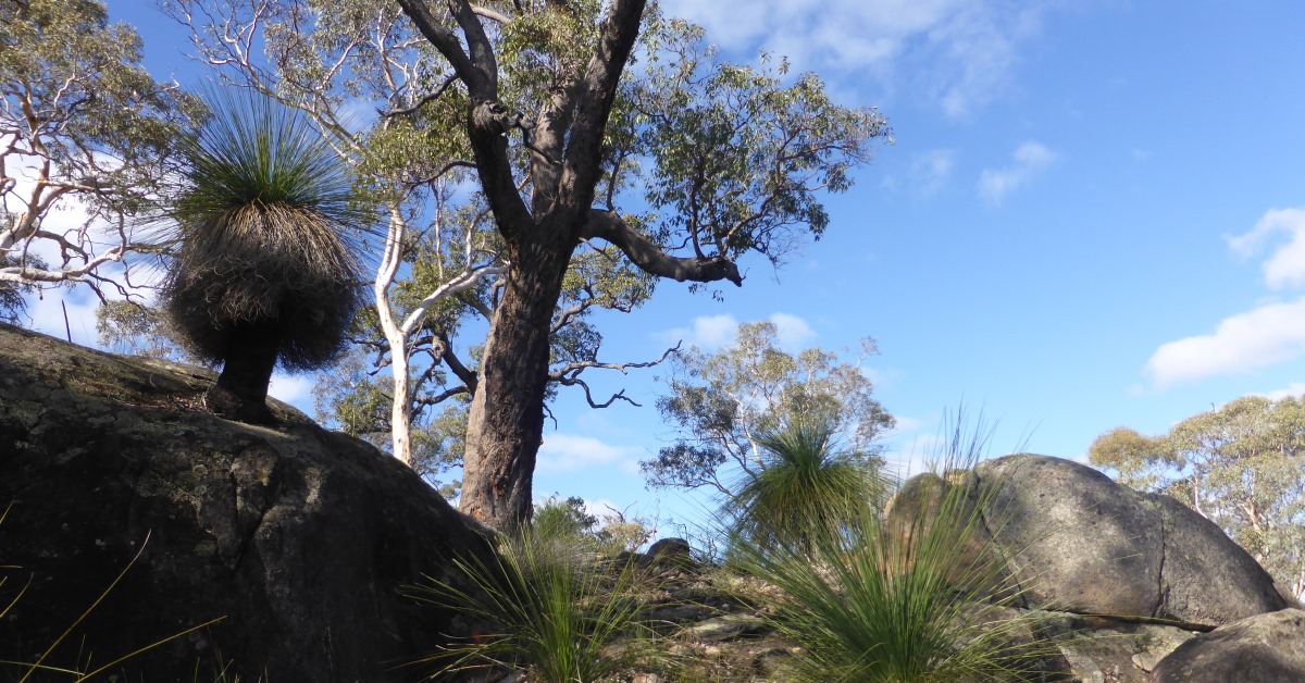
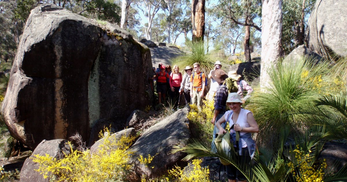
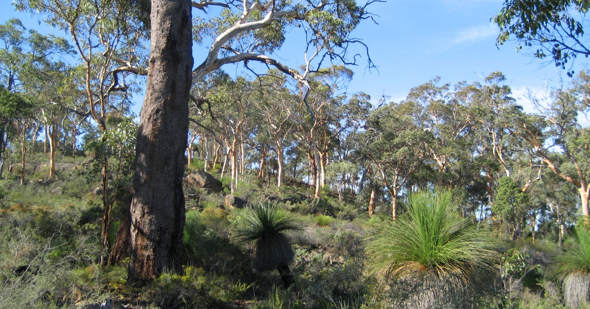
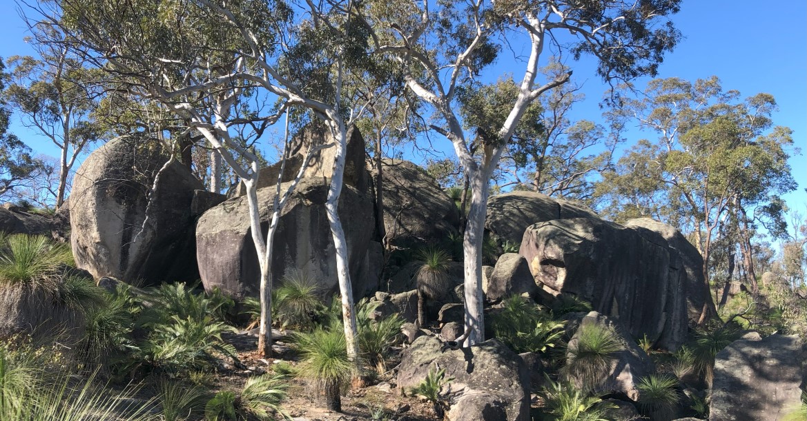
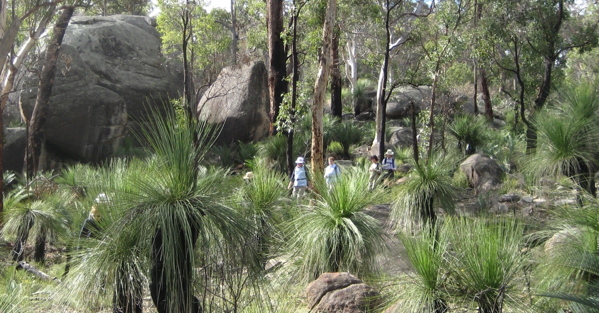
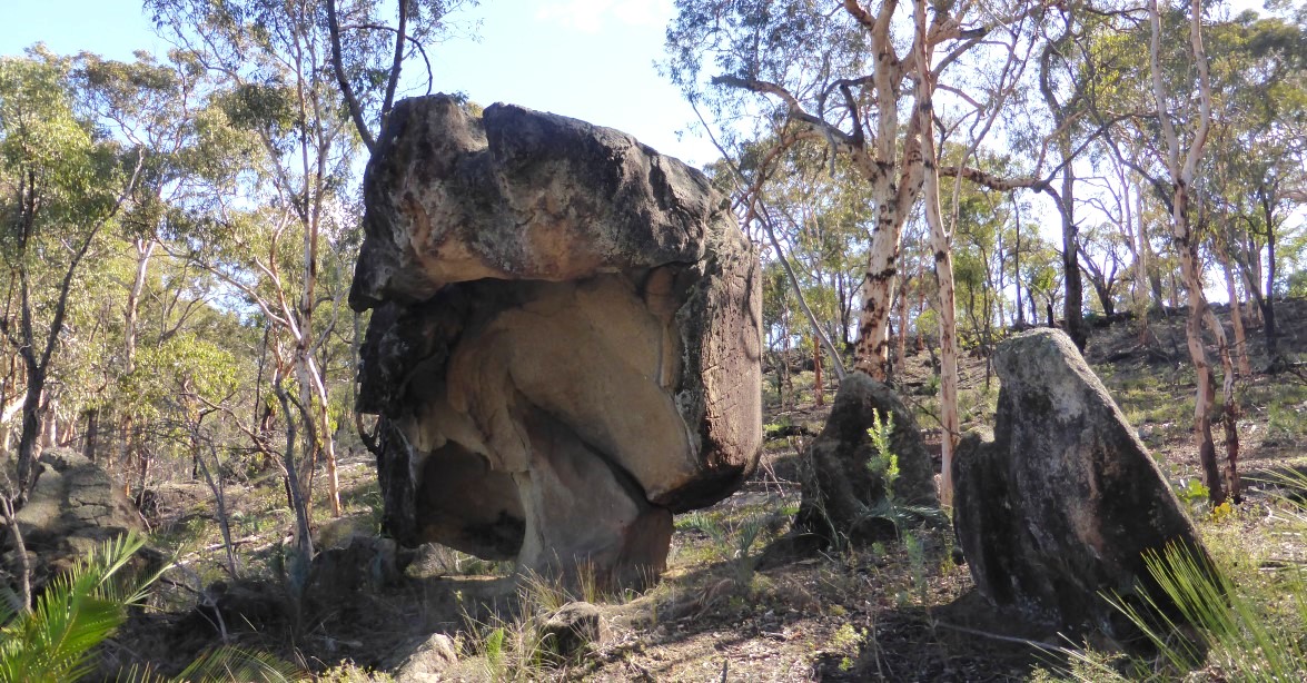
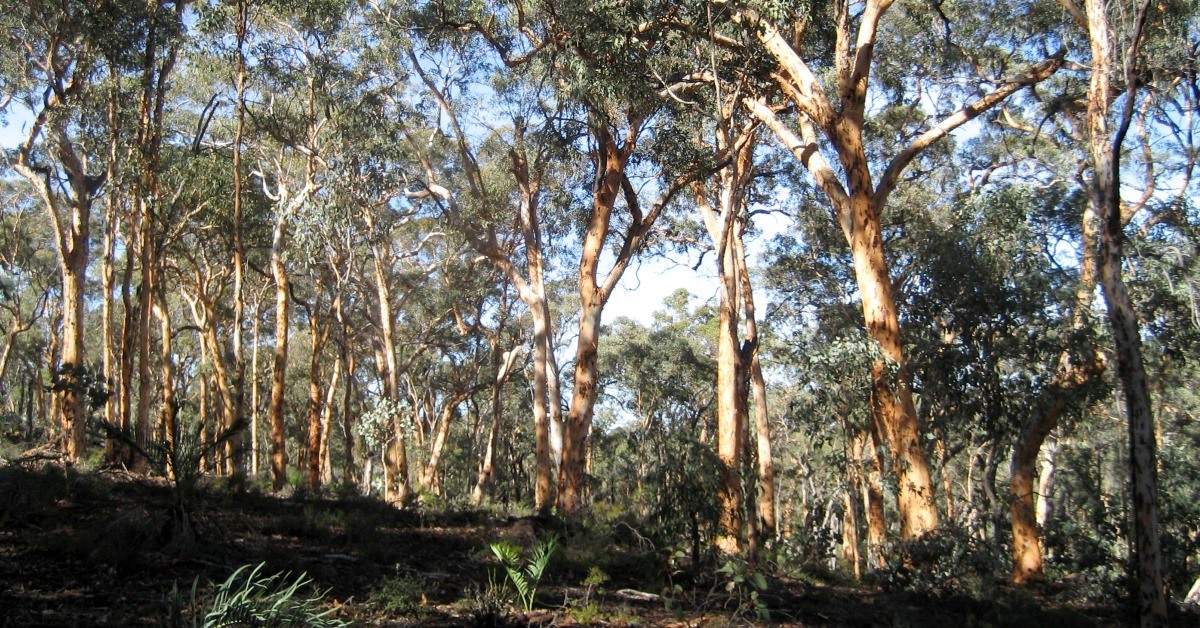
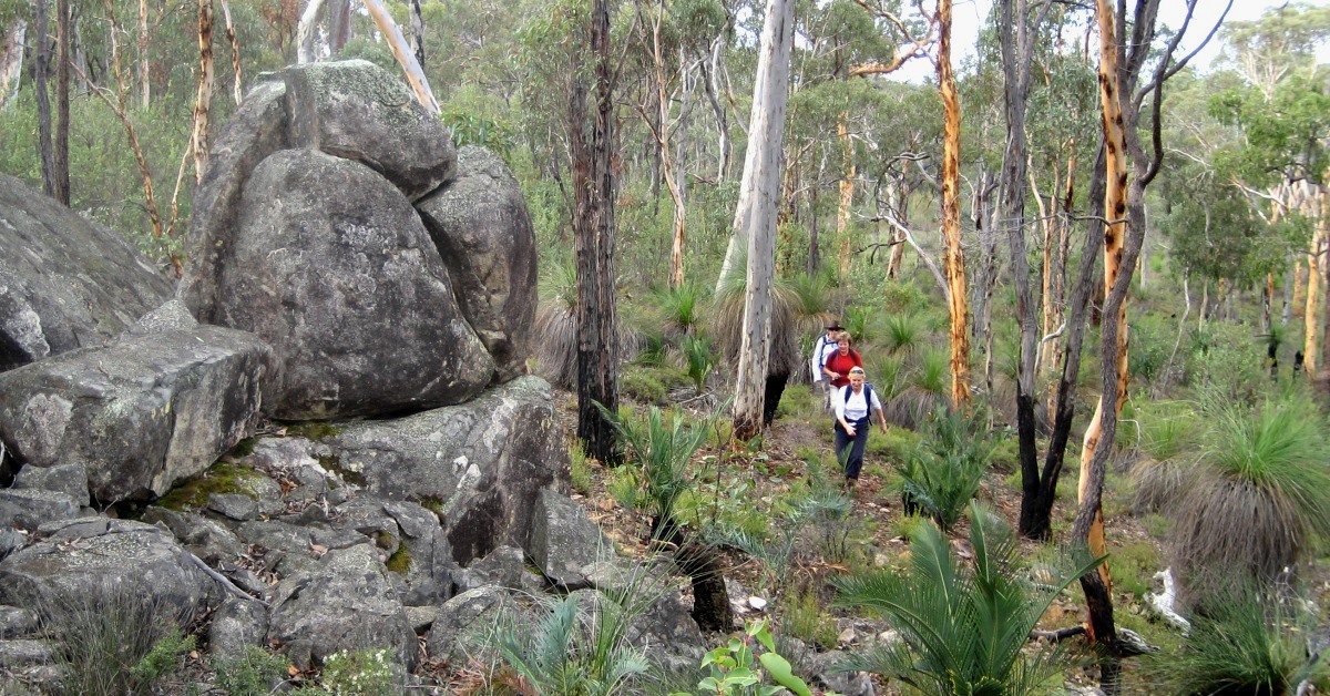
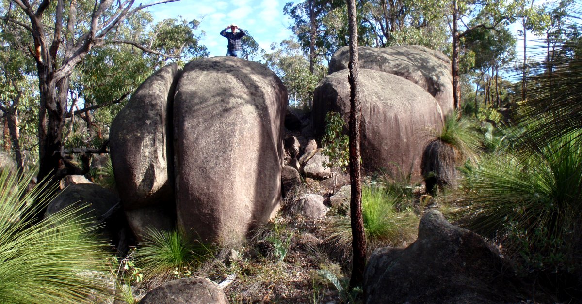
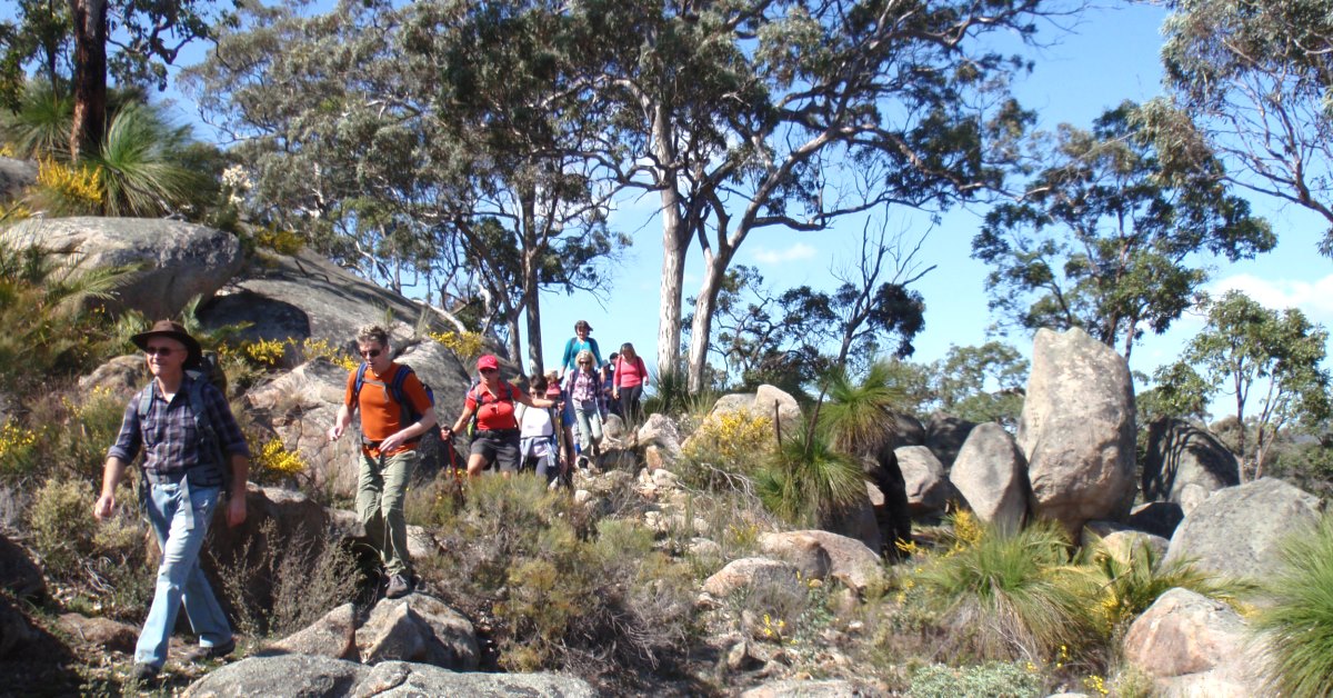
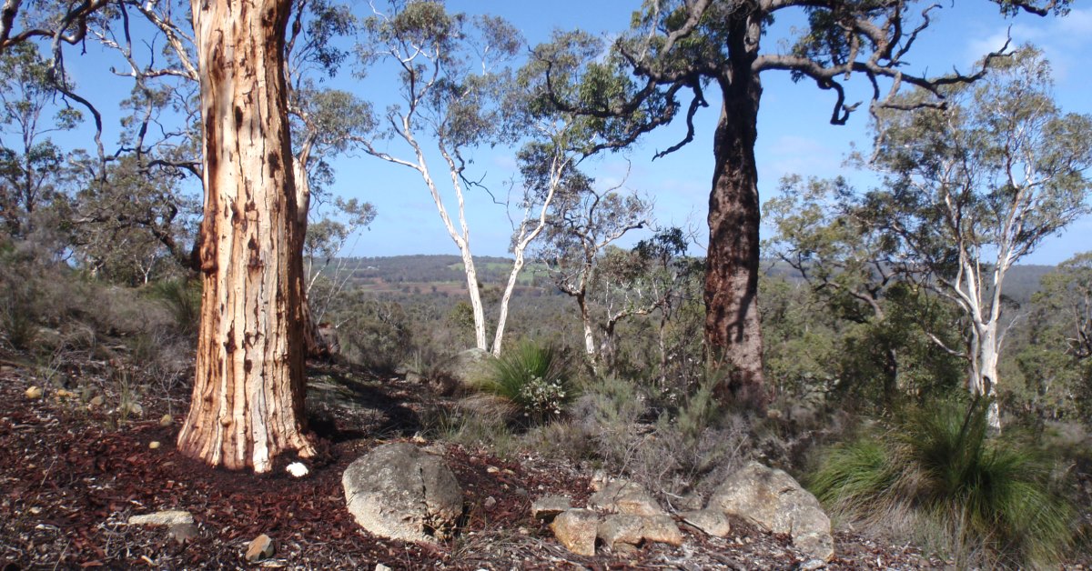
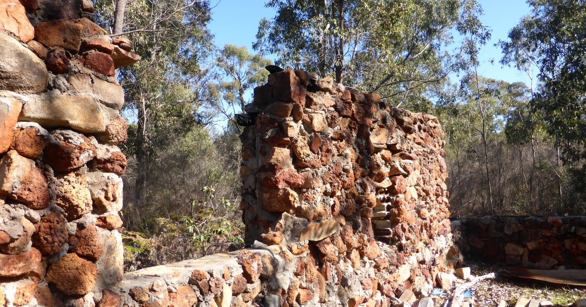
From the ‘Start’ point (waypoint ‘START) near the end of Tudor Park Rd, head eastward along the track following the fence along the boundary of The Tudor Park Stud Farm to the right. After only 100m (at ‘1’), when the vehicle track veers left up the hillside through the mixed forest of wandoo and jarrah, continue eastward, following a mostly faint old track along the fenceline. After crossing a gentle ridge, veer left to descend briefly and cross Flynn Rd at ‘1-1’. Follow a vehicle track from the east of the road down the hillside through wandoo woodland. Veer right at ‘2’ to follow a sidetrack down to Emu Brook in the gully. Follow the narrow gully SE-ward, downstream for about 10-15 minutes, crossing and re-crossing the brook whenever necessary to bypass meanders or muddy patches created by trail bike tracks. At ‘2-2’ pass a very small concrete dam and rock wall, most likely constructed to create a watering hole for livestock many years ago. The brook curves briefly eastward after ‘2-3’. Soon after, at ‘2-4’ cross the brook and pick an easy route through patches of tall heath to reach (at ‘3’) the foot of a sloping granite outcrop on the eastern flank of the gully. Climb the outcrop and re-enter the forest upslope. Veer right at ‘4’ to cross a small spur ridge and descend quite steeply through a woodland of sheoaks to cross a side gully at ‘4-1’. Reach a nearby vehicle track at ‘4-2’. Turn left to follow the track upslope for less than 50m to ‘5’. Then turn right and follow a prominent rocky ledge along slope to ‘5-1’, gaining a view through the sheoaks to distant Mt Dale, 25km to the south. Veer left (ESE-ward) to head gently upslope across rocky ground surrounded by sheoaks. Veer left (NE) at ‘6’ up a small gently sloping outcrop and cross the gentle crest of a ridge. Descend to a nearby low-lying outcrop where at ‘6-1’ there is an arranged ring of long-undisturbed rocks, a fire ring, that may date back to the known early aboriginal habitation of the area (though this could be the work of later non-indigenous visitors). Head initially along slope on the outcrop, then at ‘6-2’ descend NE-ward slightly downslope to reach another outcrop surrounded by sheoaks and low heath at ‘6-3’. Continue NE-ward, along the outcrop, then veer back upslope a little to cross another rocky area, before descending, still NE-ward, to reach yet another granite outcrop at ‘6-4’. Follow this outcrop NNE-ward, along slope to near its northern end, then turn right to head eastward across partly open and grassed, but rocky terrain around the SW flank of a gentle spur ridge.Veer eastward at ‘7’ to follow the partly open and grassed, but rocky terrain (via ‘8’) around the SW flank of a spur ridge. At ‘8-1’ veer southward for about 50m to reach a small rocky knoll (at ‘9’) which has a local view across the side valley. Then head ENE-ward through open wandoo woodland across the gentle crest of the spur ridge. Descend via ‘9-1′ across rocky ground among sheoaks and reach another gently eastward sloping outcrop. Descend the outcrop. Veer right at ’10’ through the fringing vegetation to head eastward , gently downslope through pleasant wandoo woodland with an understorey of balgas. Cross a stream course at ’10-1′ and veer a little to the left to soon reach the southern bank of a narrow gully at ’10-2′. Follow the gully eastward for a few minutes and meet a vehicle track (Wariin Road). Turn right to follow the track SE-ward. After about 10 minutes, at ‘12’, meet a junction with Cobb Road (Chauncy’s old York Road route). Turn left to follow the road eastward for only about 100m to ’13’. Veer right and head SE-ward off-track through heathland/patchy shrubland. Cross a nearby small gully (at ’13-1′), then veer left (eastward) to ’13-2′, then right (SSE) to follow a kangaroo trail down to an easy crossing (at ’13-3′) of Wariin Brook. (Avoid seeking a crossing point further upstream as the gully for 300m upstream of the crossing point can become swampy and choked with dense reeds and ponding. After crossing the Brook head eastward to meet a vehicle track at ‘14’. Follow the track eastward. A small earth dam/embankment soon appears on the right, near the approximate site of the old Wariin Well. At ’14-1′ the track below the dam may be partly flooded after winter rains. Pass a sidetrack on the left after a further 400m, and veer gently off-track to the left at ’15’ through patches of heath to head ENE-ward through very open woodland. Follow a kangaroo track along the southern bank of Wariin Brook. Re-cross the brook at ’15-1′ where it bends to the right, then soon after veer left at ’16’ to follow a side gully northward. Soon re-cross Cobb Road to continue northward through open forest along the floor of the gully. Re-cross Cobb Road (at ’16-1’). Continue northward along the stream gully through open forest. At ’16-2′, cross a deeply incised gully which drains runoff from a large granite outcrop to the north. Reach the base of the main outcrop (at ’17’) and climb steadily northward up the gently sloping outcrop (via ’17-1′), passing through a patch of shrubland after about 400m horizontal distance. The elevation gain up the outcrop is almost 60m. At ‘18’ near the highest point on the outcrop, veer NW for a short climb up a lateritic escarpment to reach a flat hilltop area (at ’19’) in wandoo woodland. This is a very pleasant spot for another break, with some views through the trees southward across the Wariin valley and also westward to Nnang’uring Hill. Descend westward from the hilltop down the laterite escarpment and across a small outcrop at ‘20’. Pick an easy route downhill to ’21’’ through interesting rocky terrain, heath and balgas. Cross a gully at ’21-1′, and head WSW through open forest. Reach a vehicle track at ’22’ (Nganguring Road, a detour off the nearby W-E powerline route). Turn left (SW-ward) to follow the track briefly. When the track begins to curve northward, veer left (westward), off-track, to reach a nearby outcrop, upslope at ’23’. Then turn left to head SSW and along the steepish slope of the hillside via ‘23-1’ and ‘23-2’, across rock slabs and across open grassy areas among groves of sheoak trees. Reach another, larger granite slab at ’24’ which slopes SE-ward and provides views across the valley. Cross the slab and continue WSW along slope via ‘25’, picking a way through patches of shrubland in the mainly open forest. On approaching a large rocky promontory, veer left via ’26’ to pass around the southern, downslope side of the giant boulders. On passing the boulders, turn right at ’27 to climb directly upslope on an outcrop. Then at ’28’ veer right, NE-ward, to climb along the edge of a steeply sloping rock slab. Soon reach a flatter heathland area and a small, but distinctive, domed outcrop at ‘29’ where you will find the historic Chauncy’s Cairn on Ngang’uring Hill at 308m elevation. There is a good view south to Mt Dale (26km SSW). This is an ideal place for a rest or lunch stop. (Note: The actual top of the hill lies about 200m further north but is only a little higher, at 316m and is blanketed by scratchy parrot bush.) Head briefly NNW-ward from the cairn location, initially across rocky ground and heath, then veer westward at ’30’. Reach another small outcrop (at ’30-1′) which offers a further view southward. Then head NW-ward along slope to ’31’ to pass by the curiously shaped ‘Helmet Rock’ (informal name). Veer left to head roughly westward, very gently downslope, through open wandoo woodland via ’31-1′ and ’31-2′. Veer left (SW) at ‘32’ to descend a short distance via ’33’ to a cluster of large boulders at ‘34’. It’s worth spending a little time exploring these interesting sculpted rocks by picking/scrambling a way through them to ‘35’ on the south side. Then head westward gently down slope through patches of heathland and balgas via ‘35-1’. Cross a small gully at ’36’, then another nearby small gully to reach an unusual and impressive, tall boulder at ‘37’ which gives the illusion of being precariously propped up by an old tree trunk. After exploring ‘Prop Rock’ (informal name) head initially westward along slope to ’37-1′ to the upper edge of a prominent rock outcrop. Veer right to head WNW, mostly along slope to ’38’, passing by another large outcrop. Then veer left to head westward again, mostly along slope through jarrah forest. At ’39’, skirt to the left around the foot of another prominent outcrop. Veer right (via ’40’) around the hillside and pass northward through a grove of sheoaks to meet Nganguring Road at ‘40-1’. Follow the deeply eroded vehicle track uphill for only 100m then turn left (NW) to head off-track at ‘41’ to reach nearby large boulders, with a small cavern beneath (at ’42’), where a small stream spills across the rocks after good rainfall. Scattered upslope from here for almost 100m are several other large boulders of various fascinating shapes and sizes. Again it is worthwhile taking some time to explore these by following a small circuit via ‘42-1’, ‘42-2’ and ‘42-3’ before coming back to ‘43’ (very close to ‘42’). Then rejoin Nganguring Road to the SW via ’43-1’. Again follow the road for only ~100m. After it crosses a gully and starts to curve to the right uphill at ’44’, head off-track SSW mostly along slope and reach the northern flank of a deeply incised stream gully at ‘45’. Veer right to follow the gully SW-ward. At ‘45-1’ cross the stream course to the southern flank and continue up the gully through wandoo woodland. After reaching the head of the gully at about ‘45-2’, veer right (WSW) and continue upslope and pass through fringing heathland to cross a natural clearing to ’45-3′. Veer left (southwest) and climb gently across a small escarpment to ‘46’ where there is a small but prominent rock outcrop. Veer right to head initially westward through open wandoo woodland across the flat hill top. Cross a trail-bike track at ’46-1′ and about 100m later veer to the right and soon reach a small area of rock outcrop at ’46-2′. Veer left to continue westward down the steepening hillside via ’46-3′. Cross a junction of trail-bike tracks at ’46-4′ near the gully floor and re-cross Emu Brook. Cross a small side gully at ’46-5′. Soon after veer right at 47′ to head WNW up the hillside through very open woodland. Re-cross Flynn Rd on the crest of the ridge and head gently downslope westward through the forest and patches of tall heath/shrubland. Veer right (NW) at ’49’ to reach a nearby clearing at ’50’. Veer left to cross the clearing and inspect the fascinating ‘ghost house’ at ’50-1′. Head SSW from these old house ruins, following a vague old track that initially passes around the edge of a sandy depression that was likely a dam along the stream course that passes close to the ruin. At ’51’, veer left (SSE) to return to the nearby Start point.