Mount Solus Walk overview

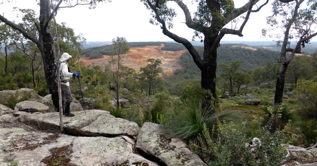
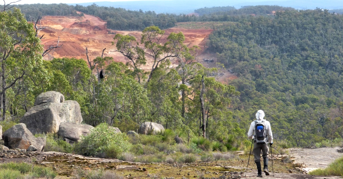
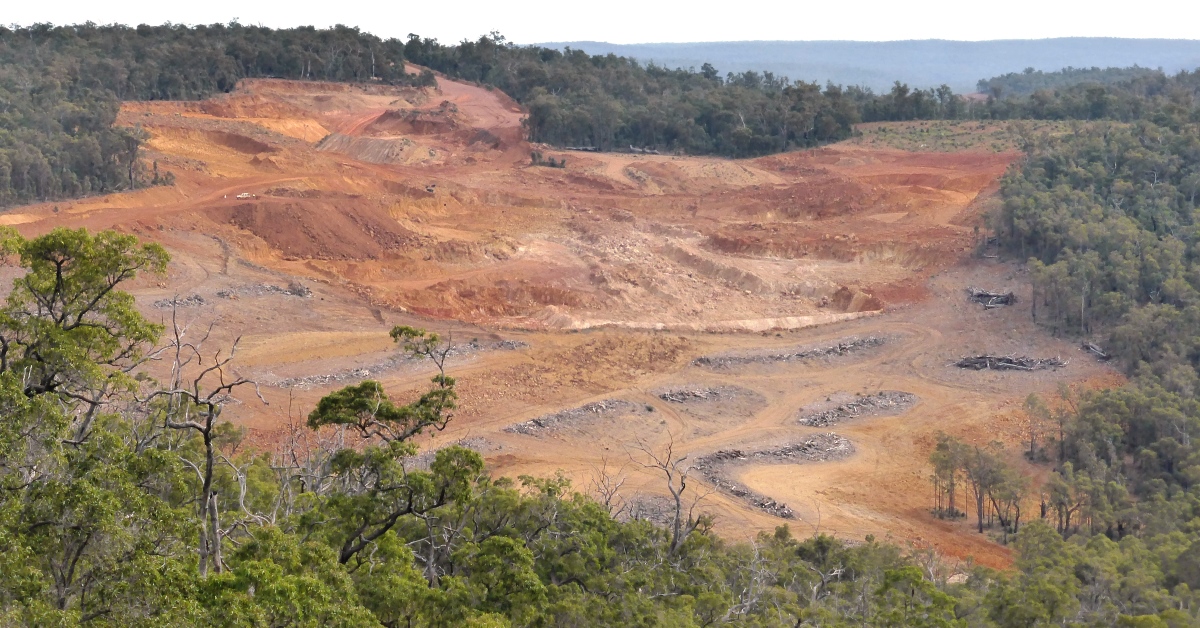
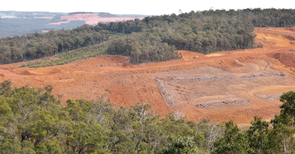
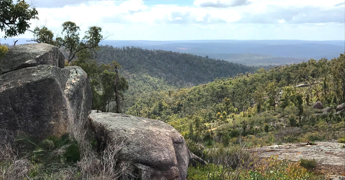
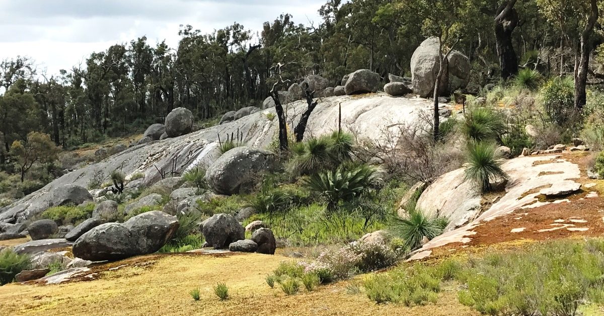
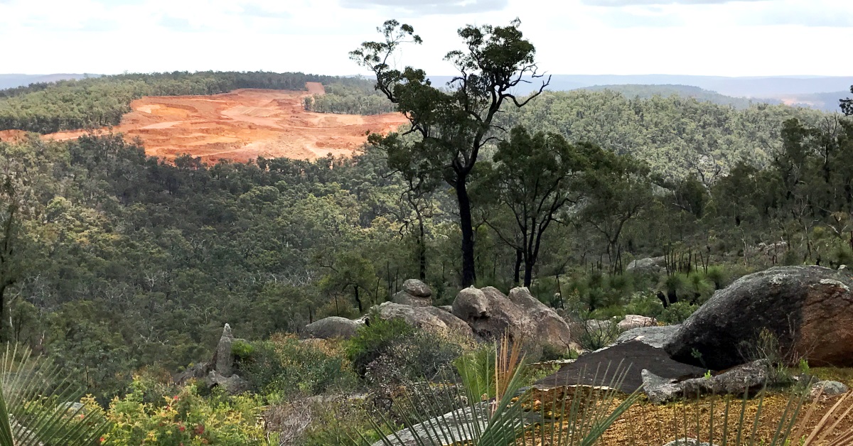
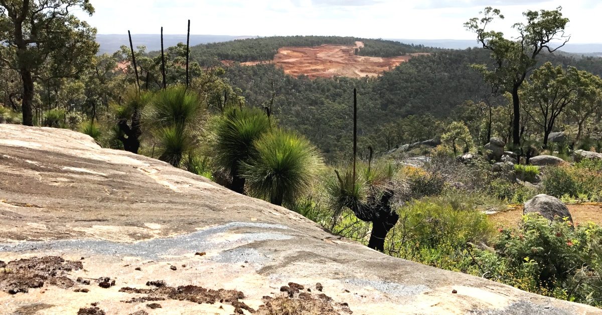
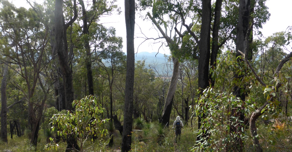
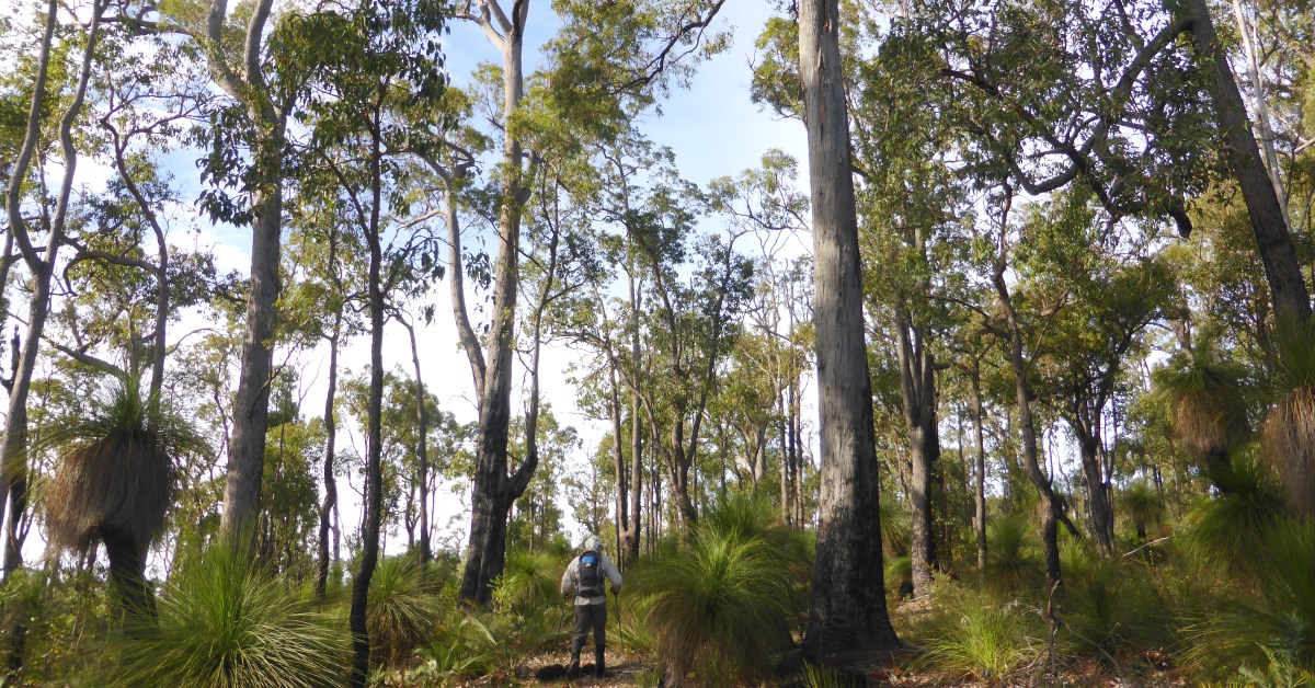
This is a nice compact walk which begins at the Serpentine River and features a traverse across Mount Solus which is one of the higher points in the Darling Range. There are good views from several points including to the Three Mountains area and Mount Cooke, but also views across extensive bauxite strip-mining operations encroaching from the southwest. The route is mostly through open marri-jarrah forest and across several granite outcrops. It also crosses at least three small streams which should be flowing after mid-winter rains. In spring there is a great diversity of wildflowers on display. The steady climb up Mount Solus is not too demanding. IMPORTANT UPDATE: Due to Alcoa’s bauxite mining operations now encroaching on this walk area in the north, walkers should not attempt this walk route at the present time (see also Alerts/Issues).

  • Main features / Highlights

    This is a nice compact walk which begins at the Serpentine River and features a traverse across Mount Solus (summit elevation 574m) which is one of the higher points in the Darling Range. There are good views from several points including toward Mounts Cooke (582m), Cuthbert and Vincent 10-14km to the NE/NNE and to the Windsor Rocks area (7km east). From near the summit area extensive bauxite strip-mining operations can also be seen encroaching from the southwest (see short video clip).

    The route is mostly through open marri-jarrah forest and across several granite outcrops.  It also crosses at least three small streams which should be flowing after mid-winter rains. In spring there is a great diversity of wildflowers on display. The steady climb up  Mount Solus is not too demanding and the gradient averages only about 1 in 10 over the last 2-3km before the summit is reached.

  • Route notes

    Head initially SW from the start point (at waypoint ‘START’) along Solus Road. Cross the bridge over the Serpentine River at ‘1’ and continue up the hillside to ‘2’. Veer left to leave the road and head southward off-track toward ‘3’, then use the waypoints from ‘3’ to ‘9’ to guide you generally southward for about 1.5km.  Along the way you will cross sloping granite outcrops between ‘3’ and ‘5’, and between ‘7’ and ‘8’. The fringing heathlands provide good wildflower displays in spring. At ‘9’ reach a small stream and turn right (upstream) to reach another outcrop. Climb the outcrop to ‘10’ (gaining a westward view across to the northern ridge of Mt Solus), then veer NE through forest. Cross a vehicle track on the crest of a gentle ridge at ‘11-1’ and descend partly through shrubland and heath to ’12’ on the eastern flank. Then veer SE  and cross a patchy, partly heath-covered granite outcrop (and a slope of Slender Smokebush flowers in spring). There are good views from here to Mount Cooke (8km NE) and to the large outcrop at Windsor Rocks (7km due east). Re-enter the forest after ’13’. Cross the crest of a small ridge to ‘13-1’, then walk south across another outcrop area to ’13-2′ and meet a minor vehicle track (from DBCA – Parks and Wildlife prescribed burn operations). Follow the track downslope for only 30m then veer right to head southward along slope through forest to ‘14’.  Then veer left (ESE) to descend through forest and a thickening Water Bush understorey (though possibly temporarily removed if there has been a recent prescribed burn). Cross a narrow gully at ’14-1′ (using the fallen log as a bridge to cross the stream if your balance is OK!) and reach the lower slope of a nearby granite outcrop, with a small cairn at ’15’. Continue approx. SE  up the outcrop via ‘15-1’ and re-enter the forest, climbing more steeply to reach a ridge at ’16’. Walk almost due south via ‘16-1’, initially close to the ridge crest. The ridge soon flattens. Veer right (SW) at ‘17’  before arriving at the T-junction of two forestry vehicle tracks. Follow the track that leads straight ahead, SW-ward, via ’17-1′, for about 250m to ‘18’. Then veer right (SW) off-track and cross a stream course at ‘18-1’. Meet an old N-S vehicle track at ‘19’ and turn left (southward). The track soon curves right (westward) and the original road joins from the left at ’19-1’. Continue quite steeply uphill and when the main track begins veering right at ‘20’, continue straight ahead directly upslope on an old disused forestry track to cross Solus Road. Follow another forestry vehicle track uphill from ’20-1′. The track very soon veers WNW and climbs gently along the narrow, forested SE ridge of Mt Solus. (Note: Depending on the timing of prescribed burning in the area, you may notice a strange and striking contrast in vegetation on either side of the track along the ridge. On the south side of the track, a dense understorey of Water Bush, Bossiaea aquifolium, had become established in recent years, resulting in a monotonous, ‘monoculture’ understorey; in contrast to the much more open and diverse understorey on the northern side, more typical of the original jarrah forest understorey. These differences are probably temporary and reflect variations in the timing of prescribed burning and land disturbance associated with past and recent forestry operations. Water Bush also appears to have become more prevalent in several other parts of the Mount Solus area disturbed by forestry operations in recent years.)  At ’21’ the track veers left (SW), giving a good view to distant Boonerring Hill, 18km SE and across the extensive active bauxite strip-mining operations expanding onto the southern and western flanks of Mount Solus itself. At ‘21-1’ consider making a worthwhile very short (30m) diversion downslope to the left to ‘21-2’  to take in the expansive view from a SE-sloping granite outcrop before returning to the track. The track flattens onto the Mount Solus summit ridge, then descends for about 100m to meet another track at a tight bend at ‘22’. Turn right to follow this track on its short steep ascent to the summit of Mount Solus at ‘22-1’, close to a prominent, fenced-off  fire lookout tower. The summit area is about the halfway point on the walk and a good spot for a rest stop. There are good views to Mounts Vincent and Cuthbert (14km NNE) from rocks near the summit. Descend approx NNW from the summit, passing granite boulders and reaching the top of a granite outcrop at ‘22-2’. Follow the outcrop quite steeply downslope via ‘22-3’ to the NW (with some good views to the NW). Then head initially NE-ward from ‘23’ back up the outcrop, through patches of shrubland and into the relatively open forest on the ridge. Pick a route across or around a large boulder at ‘25’ and turn left to descend to the top of another large west-sloping outcrop (with a good view again to the NW).  Continue north via ‘25-1’, again picking a route around large boulders. At the north end of the outcrop at ‘26’ re-enter forest and climb a little onto the ridge top at ‘27’.  Continue along the ridge to ‘27-1’ then descend for almost 1 km down the northern slope of Mt Solus through mainly open forest via ‘27-2’ to a small outcrop at ’28’. Head NNW down the outcrop and meet a nearby forestry vehicle track at ‘29’. Turn left to follow the track a short way westward to ‘30’ and then head NNW off-track (bypassing timber debris from intensive logging operations in this area in recent years) to reach a larger (400m long) outcrop at ‘31’ (with flowering Verticordia in spring). Descend the outcrop northward to ’31-1′.  Veer NNE to cross a gully and re-enter forest. Meet another forestry vehicle track at ’32’. Follow the road northward gently downhill via ‘32-1’ until the road bends sharply westward (to left) at ‘32-2’. Then head NE-ward off-track to soon reach another outcrop at waypt ‘33’ (with view to Mount Cooke, 10km NE). Veer eastward and follow the patchy outcrop approx. along slope, partly through open heath, then at ‘34’ descend through forest to reach Mountain Road at ‘35’. Follow the road SE to the junction with Solus Road at ‘36’. Finally follow Solus Road to retrace your steps from the outbound route via ‘2’ and ‘1’ back to the start point.

  • Access / Directions

    39km SE of Armadale, along Albany Hwy to Solus Road on right,  then approx. 6km along Solus Road (good condition dirt road).  Park on roadside approx. 6km along Solus Road near poorly marked River Road track on right and before road crosses Serpentine River (and just before old Thorpe Road track on left).

    Google Map

  • Nearest campsite/s

    N/A.

  • Escape route/s

    Via Solus Road (through middle of walk area) or Mountain Road to west, or Thorpe Road to east.

  • Other Info.

    “Changing the Mount Solus landscape”, WalkGPS video. –  A short (30 sec.) clip of ALCOA bauxite mining operations expanding onto the forested slopes of Mount Solus in 2011.

    Other map availability

    South West WA 25K Scale Topo Maps”, Greg Harewood & Landgate, 2015.  – Digital raster; ECW format on 16GB USB. See tile #303-2133-III-SE for relevant map coverage.

Back to top