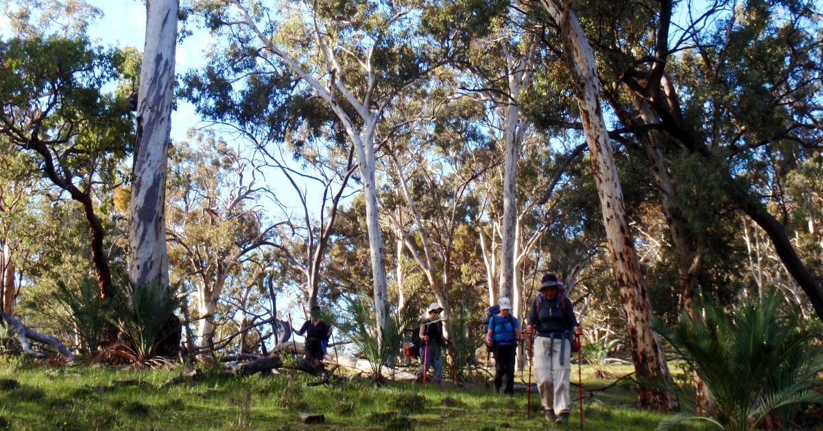
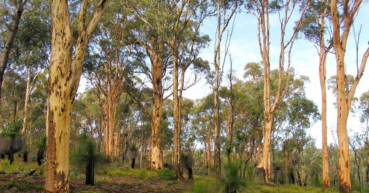
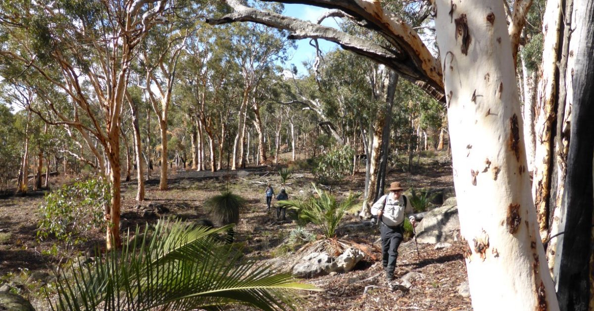
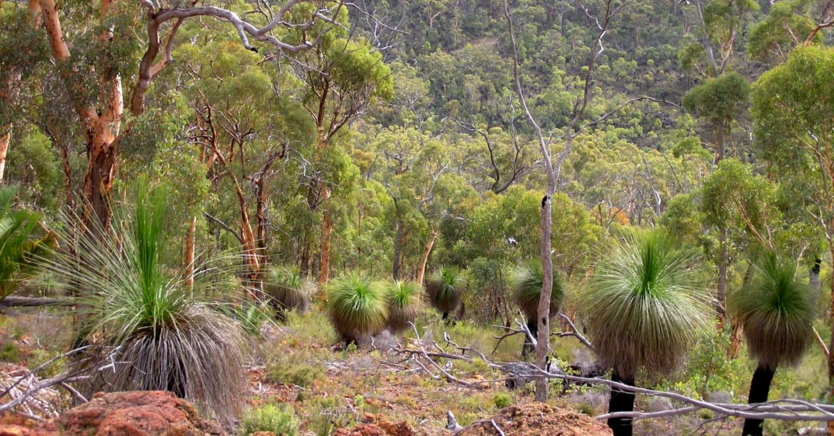
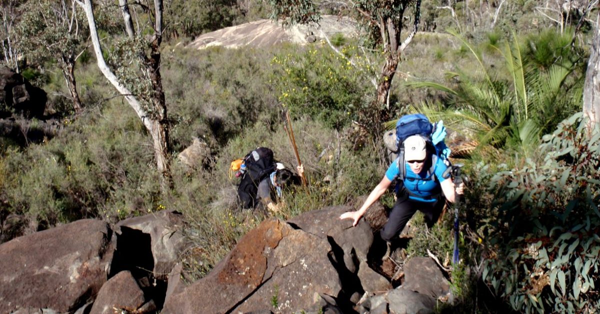
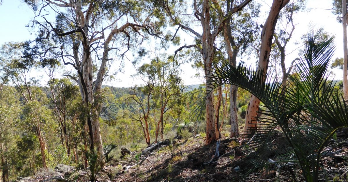
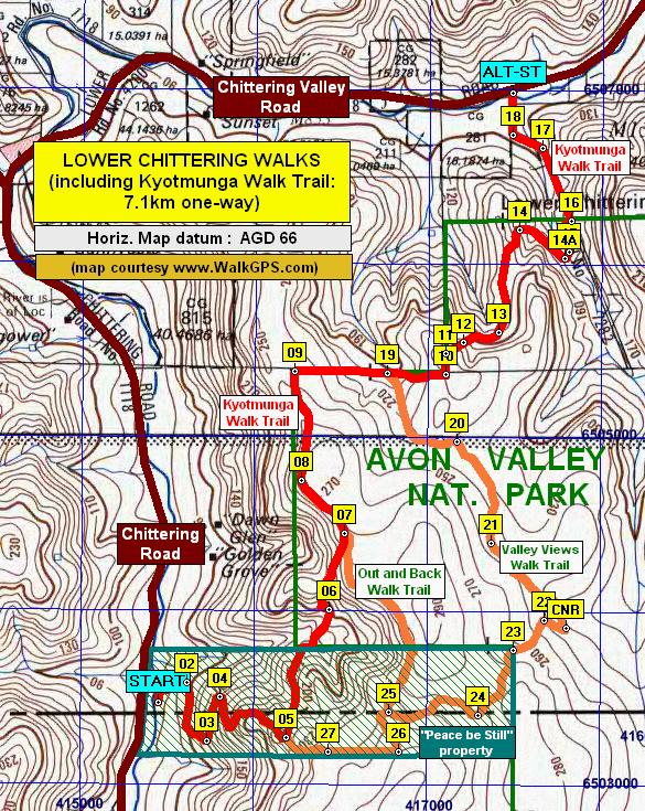
Start from the Homestead Campsite (waypoint ‘START’). Cross the nearby stream course at about ‘1’ and then climb gently southward up and along the hillside through open wandoo-dominated woodland and low heath and cross a side gully at ‘2’. (Or see Option 1 below to bypass the initial 4km section which has become denser and more scratchy following re-growth after control burns). After almost 1km (at ‘3’), veer right (SW), initially along slope and then gently downhill to reach a stream course after about 700m. Veer left (approx. south) to cross the stream course (at about ‘4’) and climb gently for 500m through mixed forest to reach a stand of tall wandoo trees (at ‘5’) near the ridge. Veer sharp right (~WSW) and descend to soon cross another stream course, then climb gently and then along slope through mixed forest and some shrubland. Veer west at ‘7’ to soon reach an area of shrubland and balgas and then (at ‘8’) a broad sandy stream course. Follow upstream along the valley floor and meet a N-S vehicle track at ‘9’. Turn right to follow the road north for 600m, then turn left at ‘10’ onto an older vehicle track to follow it approximately west for only 150m to meet another South Break (firebreak vehicle track) at ‘11’. (Note: Be cautious if considering taking a short-cut route from ‘9’ direct to ’12’: That possible option shortens the walk by about 500m but likely passes through quite dense and scratchy dryandra shrubland, and progress will be slow and uncomfortable unless a recent burn happens to have temporarily lightened the vegetation.) Turn left (SW) at ‘11’ and follow South Break for 500m then turn right at ’12’ to head westward off-track to meet a vehicle track at ‘12-1’. (Alternatively, if the off-track section ahead at ‘12’ also appears too overgrown, stay on South Break to detour on-track via ‘12-1-alt’ to reach ‘12-1’.) Turn right at ‘12’ to follow the joining vehicle track road initially NNW and then west. Veer left off the road at ’13’ to head downhill to cross a stream course at ‘14’ and reach a small low outcrop surrounded by fairly tall heath. Veer west to head down the valley keeping quite close to the south side of the stream course for about 500m toward ‘15’. You will now cross the stream 3 times over the next 300m to follow the easiest route downstream. i.e. Cross the stream course to ‘16’ to avoid denser shrubland on the south side, but soon re-cross to ‘17’ on the south side and again to the north bank to cross a vehicle track upslope at ‘18’. Then climb ~WNW quite steeply to reach the edge of a laterite-capped ‘plateau’ surface after about 400m. Continue WNW, following the edge of the plateau to ‘20’, then descend a steep rocky slope to cross a deeply-incised stream at ‘21’. Climb for a short distance through open woodland to a saddle (at ’22’) in very open woodland. This is approx. the halfway point on the walk. (Note: There is a small forested promontory immediately to the west of the saddle, with the high point, the ‘KNOB’, about 200m west of ’22’; but the very limited views from that point are disappointing.) From the saddle, head approx. northward and climb gently along the steepening rocky slope, following a well worn animal trail (sadly the ample ‘scats’ evidence indicates this is mostly from feral goat traffic rather than kangaroos) and gaining views across the Avon Valley. (See Option 2 below for possible diversion to visit historic Cairn “OS”.) – If feeling energetic, at about ’23’ you can opt to take a short, 150m detour steeply uphill toward the SE, off the main route, to visit the location at ‘CRN0S’ of Cairn “OS”. This was one of several cairns placed by John Forrest’s surveying team in early 1878 on observation points overlooking the valley. The current small rock cairn is up a steepish slope, and is located on a small outcrop, just south of a larger dolerite outcrop. For safety during the uphill climb from ’23’ veer around the north side of the steep dolerite rock outcrops. When leaving the cairn, don’t descend to rejoin the main route immediately, but instead head direct to ’27’, mainly along-slope for easy walking through very pleasant open wandoo woodland.) If staying on the main route, at ’23’,veer NE and continue mainly along slope to ’24’, then veer more eastward to climb gently across the slope (via ’25’, and ’26’) to ’27’ which is just downslope from the edge of the laterite plateau. At ’28’ veer right (SE), along slope and soon climb onto the laterite surface, passing from the very open woodland on the slope into dryandra shrubland on the plateau. Pick an easy route through the Parrot Bush via ‘29’ and soon descend SE via ‘30’ back into woodland around the flanks of the plateau. At ’31’, veer eastward near a stream gully and continue initially along slope through wandoo woodland before climbing back up onto another flat laterite-capped ‘plateau’. Continue eastward through heathland along the northern edge of the plateau to ’32’. Then veer NE and soon begin descending via ‘33’through forest and heath. Continue descending, and partly scarmblinmg, down a steepening, partly rocky ridge via ‘34’ to a small but prominent granite outcrop at ’35’. This provides good eastward views across the side valley and a northward view toward Bald Hill and is a good spot for a rest stop. Then veer approx. SE to descend (via ’36’) through forest and heath. Cross a N-S stream gully at ’37’. Then climb initially SE-ward through fairly thick shrubland and heath to a small outcrop at about ’37-1′. Follow the outcrop upslope via ‘37-2’, then veer left (NNE) initially along slope to cross more rocky outcrops and heath. Continue NNE via ‘38’ (from where there is a good view west back across the side valley) and soon cross a vehicle track at ‘39’. Veer ~NNW along the hillside via ‘40’ and ‘41’, mostly following a kangaroo trail slightly downslope. Reach a steeply sloping granite outcrop at ‘42’ with a view NNW down the side vallley to Avon Valley and another good spot for a rest stop. Veer right to climb initially quite steeply NE through shrubland and over rocky ground. Soon reach the flatter laterite surface and continue NE for about 500m through shrubland, crossing an old vehicle track at ‘43’ before reaching Governors Drive (at ’44’). Follow Governors Drive eastward for about 700m to ’45’. (See Option 3 below for possible shortened walk from this point.) Veer northward offtrack at ’45’, soon descending more steeply through forest and shrubland to ’46’. Then veer NW initially through woodland and then heathland, gaining some views across the side valley. Near ’48’ reach a granite outcrop. Veer left to descend the outcrop to reach within 40m a rocky stream gully (at ’49’). (A short diversion of about 100m westward down the gully from this point would take you quite close to the top of Emu Springs Falls. The falls drop about 30m but are hidden from sight from this position and the sheer granite rock faces make any closer approach from this direction too dangerous. (Note: The Falls can best be viewed, from a separate, short but steepish walk along a rough foot-track from Drummonds campsite which is reached off Governors Road.) Follow the stream course upstream eastward along the bank via ‘50’, ‘51’, ‘52’ and ’53’ finding an easy route through the mostly fairly open shrubland and open forest. Cross a granite ledge along the stream course at ‘53’ and veer right (SE) at ‘54’ to leave the gully. Initially climb gently SE-ward via ‘54-1’ through heath and open woodland and then walk along slope to cross South Break vehicle track at ‘55’. Veer left (ESE) and cross a narrow gully at ’55-1’. Continue ESE to soon meet Governors Drive (at ’56’). Turn left to follow Governors Drive for only 100m to return to the Start point at the Homestead Campsite.
Option 1, to bypass initial, mainly off-track section: The vegetation along the initial 3.5km of the route has become denser and more scratchy due to vigorous understorey re-growth following control burns in recent years. You can bypass this section by simply following Governors Drive westward to South Break track, then follow South Break track SW to waypoint ‘11’ to continue along the described route from there. That’s a few initial kms of on-road and on-track walking, but will also shorten the walk by about 1.5km.
Option 2 for possible diversion to visit historic Cairn “OS”: If feeling energetic, at about waypoint ’23’ you can opt to take a short, 150m detour steeply uphill toward the SE, off the main route, to visit the location at ‘CRN0S’ of Cairn “OS”. This was one of several cairns placed by John Forrest’s surveying team in early 1878 on observation points overlooking the valley. The current small rock cairn is up a steepish slope, and is located on a small outcrop, just south of a larger dolerite outcrop. For safety during the uphill climb from ’23’ veer around the north side of the steep dolerite rock outcrops. When leaving the cairn, don’t descend to rejoin the main route immediately, but instead head direct to ’27’, mainly along-slope for easy walking through very pleasant open wandoo woodland.
Option 3 for shortened walk (after waypoint ’45’): From this point, if you prefer to shorten the walk by about 1.5km, simply continue eastward along Governors Drive for ~1.3km back to the Start point. This option overlaps with part of the on-road walking in Option 1 (in opposite direction).